Thanks to modern technologies, scientists have been able to calculate how many earthquakes occur on our planet every year. There are more than a million of them recorded. Most of them are not felt by people due to their low magnitude, but there are those that become a real disaster.
What is the magnitude of earthquakes and how is it measured? How do scientists determine which events will cause damage and which will go unnoticed?
Magnitude
Scientists have developed special scales that measure the strength of tremors. To understand what the magnitude of an earthquake is, it is necessary to become familiar with the measurement values of this phenomenon.
There are several types of scales: Mercalli - Cancani, Medvedev - Sponheuer - Karnik, Richter. Thanks to them, it is clear what magnitude is. It is a number that can be measured against a specific benchmark. During the next earthquake, it is customary to talk about the severity and magnitude.
Richter earthquake magnitude scale: appearance, calculation principle and what instruments are used to measure it
An earthquake is a natural disaster that affects residents of seismically active areas of the Earth. An earthquake almost always comes suddenly and destroys entire cities with lightning speed, drawing a line between “before” and “after.”
But even in such a sudden and destructive phenomenon, scientists have long found options for observing, calculating and calculating the strength of tremors. The Richter scale, which we will talk about today, is precisely the unit for measuring the strength of an earthquake and is widely used in seismology to this day.
The Richter scale is an international unit of measurement that defines and classifies quantities: the strength and speed of shaking of the earth's crust at the onset of seismic activity.
The scale is based on measuring the energy released by the movement of the crust at the epicenter. The strength of an earthquake is measured from the energy, that is, the magnitude of the earthquake. The magnitude of an earthquake is a value that characterizes the energy released during an earthquake in the form of seismic waves.
It is worth noting that magnitude (Richter scale) is not the same as the intensity of an earthquake. The latter is calculated using scales of wave intensity in the earth's surface.
Earthquake intensity is a measure of the magnitude of the shaking of the earth's surface during an earthquake in the area affected by it.
Magnitude scale
For a long time, the Mercalli-Cancani grid was considered the very first scale. Nowadays, it is an outdated model, so the value of tremors is not measured with it.
However, on its basis, all modern methods for assessing the force of impacts have been developed, including the international scale MSK 64 (Medvedev-Sponheuer-Karnik). It is taken in most countries of the world to analyze the intensity of the phenomenon.
Summary of Epicenter vs. Hypocenter
The epicenter is the point on the Earth's surface directly above the ground where an earthquake occurs by mistake. The hypocenter is the actual point at which an earthquake occurs along a fault beneath the earth's surface. They both provide a reference point for seismic waves, but the epicenter is at the surface of the Earth and is used to measure the 2D propagation of seismic waves, whereas the hypocenter is used to measure the 3D propagation of seismic waves and is the actual source of the seismic waves. In addition, surface waves will also propagate from the epicenter, whereas only wave bodies are initially associated with the earthquake's hypocenter.
MSK 64
This rating system is represented by a twelve-point scale. From it you can find out what characterizes the magnitude of an earthquake:
- 1 point. Such phenomena are not felt by people, but they are recorded by devices.
- 2 points. In some cases they can be observed by people, most often on the upper floors of buildings.
- 3 points. The shocks are noticeable to those with high sensitivity.
- Earthquake 4 points. Glass rattling is noted.
- 5 points. It is considered a fairly noticeable earthquake, during which individual objects can sway.
- 6 points. Formation of cracks in buildings.
- 7 points. Heavy objects may fall. Large cracks appear in the walls of buildings.
- 8 points. Houses are partially collapsing.
- 9 points. Buildings and other structures are collapsing.
- 10 points. Deep cracks appear in the ground, old buildings are completely destroyed.
- 11 points. Numerous cracks appear on the surface of the earth, and landslides occur in the mountains. The buildings are completely destroyed.
- 12. The relief is seriously changing, and buildings are completely destroyed.
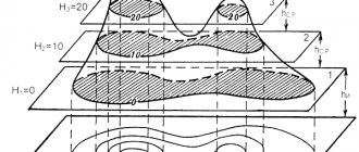
Paths of seismic waves.
Longitudinal and transverse waves propagate throughout the Earth, while the volume of the medium involved in the oscillatory process continuously increases. The surface corresponding to the maximum movement of waves of a certain type at a given moment is called the front of these waves. Since the elastic modulus of a medium increases with depth faster than its density (up to a depth of 2900 km), the speed of wave propagation at depth is higher than near the surface, and the wave front appears to be more advanced inland than in the lateral (lateral) direction. The path of a wave is a line connecting a point at the wave front to the source of the wave. Directions of wave propagation P
and
S
are curves that are convex downward (due to the fact that the wave speed is greater at depth).
the P
and
S
waves coincide, although the former propagate faster.
Seismic stations located far from the epicenter of an earthquake record not only direct P
and
S
, but also waves of these types, already reflected once from the Earth’s surface -
PP
and
SS
(or
PR
1 and
SR
1), and sometimes reflected twice -
PPP
and
SSS
(or
RR
2 and
SR
2).
There are also reflected waves that travel one part of the path as a P
-wave, and the second, after reflection, as an
S
-wave.
The resulting converted waves are designated as PS
or
SP.
In seismograms of deep-focus earthquakes, other types of reflected waves are also observed, for example, waves that were reflected from the Earth's surface before reaching the recording station.
They are usually denoted by a small letter followed by a capital letter (for example, рR
). These waves are very convenient to use to determine the depth of the earthquake source.
At a depth of 2900 km, the speed P
-waves decrease sharply from >13 km/s to ~8 km/s;
and S
waves do not propagate below this level, corresponding to the boundary of the earth's core and mantle
.
Both types of waves are partially reflected from this surface, and some of their energy returns to the surface in the form of waves designated as
PcP
and
ScS
.
P
-waves pass through the core, but their trajectory is sharply deviated and a shadow zone appears on the Earth's surface, within which only very weak
P
-waves are recorded.
This zone starts at a distance of approx. 11 thousand km from the seismic source, and already at a distance of 16 thousand km P
-waves appear again, and their amplitude increases significantly due to the focusing influence of the core, where wave velocities are low.
P
-waves passing through the earth's core are designated
RKR
or
R
ў
.
The seismograms also clearly distinguish waves that, on the way from the source to the core, go as
S
, then pass through the core as
P
, and upon exiting the waves again transform into type
S.
In the very center of the Earth, at a depth of more than 5100 km, there is an internal a core that is presumably in a solid state, but its nature is not yet entirely clear.
Waves penetrating through this inner core are designated PKIKR
or
SKIKS
(
see
Fig. 1).
Richter rating system
In 1935, scientist C. Richter suggested that magnitude is the energy of seismic waves. Based on this statement, he developed a special scale, which is still used to assess shaking activity.
The Richter magnitude scale characterizes the amount of energy released during seismological activity. It uses a logarithmic scale, with each value indicating a shock ten times larger than the previous one. For example, if a magnitude 4 earthquake is recorded, the phenomenon will cause a ten times stronger vibration than a magnitude 3 earthquake on the same scale.
According to Richter, seismological activity is measured as follows:
- 1.0-2.0 – recorded by instruments;
- 2.0-3.0 – weak sensations of tremors;
- 3.0 – chandeliers in houses are swinging;
- 4-5 – shocks are weak, but can cause minor damage;
- 6.0 – tremors capable of causing moderate destruction;
- 7 – it is difficult to stand on your feet, cracks begin to appear along the walls, flights of stairs may collapse;
- 8.5 – very strong earthquakes that can cause changes in relief.
- 9 – causes a tsunami, the soil cracks severely.
- 10 – the depth of the fault is one hundred or more kilometers.
Richter scale - classification of earthquakes by magnitude
Earthquakes of different magnitudes (on the Richter scale) manifest themselves as follows: 2.0 - the weakest felt tremors; 4.5 - the weakest shocks, leading to minor damage; 6.0 - moderate damage; 8.5 - the strongest known earthquakes.
Scientists believe that earthquakes stronger than magnitude 9.0 cannot occur on Earth. It is known that each earthquake is a shock or a series of shocks that arise as a result of the displacement of rock masses along a fault. Calculations have shown that the size of the earthquake source (that is, the size of the area on which the rocks were displaced, which determines the strength of the earthquake and its energy) with weak tremors barely perceptible by humans is measured in length and vertically by several meters.
During earthquakes of medium strength, when cracks appear in stone buildings, the size of the source reaches kilometers. The sources of the most powerful, catastrophic earthquakes have a length of 500-1000 kilometers and go to a depth of up to 50 kilometers. The largest earthquake recorded on Earth has a focal area of 1000 x 100 kilometers, i.e. close to the maximum length of faults known to scientists. A further increase in the depth of the source is also impossible, since earthly matter at depths of more than 100 kilometers goes into a state close to melting.
Magnitude characterizes an earthquake as a single, global event and is not an indicator of the intensity of the earthquake felt at a specific point on the Earth's surface. The intensity or strength of an earthquake, measured in points, not only strongly depends on the distance to the source; Depending on the depth of the center and the type of rock, the strength of earthquakes with the same magnitude can differ by 2-3 points.
The intensity scale (not the Richter scale) characterizes the intensity of the earthquake (the effect of its impact on the surface), i.e. measures the damage caused to a given area. The score is established when examining the area based on the magnitude of destruction of ground structures or deformations of the earth's surface.
There are a large number of seismic scales, which can be reduced to three main groups. In Russia, the 12-point scale MSK-64 (Medvedev-Sponheuer-Karnik), which is the most widely used in the world, is used, dating back to the Mercalli-Cancani scale (1902), in Latin American countries the 10-point Rossi-Forel scale (1883) is adopted, in Japan - 7-point scale.
The intensity assessment, which is based on the everyday consequences of an earthquake, which are easily distinguishable even by an inexperienced observer, is different on the seismic scales of different countries. For example, in Australia, one of the degrees of shaking is compared to “the way a horse rubs against a veranda post”; in Europe, the same seismic effect is described as “bells begin to ring”; in Japan, “an overturned stone lantern” appears.
The material was prepared based on information from open sources
Earthquakes in history
One of the most powerful earthquakes in the world was the seismological activity recorded in 1960 in Chile. On the Richter scale, the instruments indicated significant activity. Then the Chileans learned what a magnitude of 8.5 was. The tremors caused a tsunami with waves ten meters high.
Four years later, in the northern part of the Gulf of Alaska, earthquakes with a magnitude of 9 were recorded. Due to this plate activity, the coastlines of some islands have changed greatly.
Another powerful earthquake occurred in 2004 in the Indian Ocean. On the Richter scale it is assigned 9 points. The tremors caused a powerful tsunami with a wave height of more than fifteen meters.
In 2011, an earthquake occurred in Japan, which caused a huge tragedy: thousands of people died and a nuclear power plant was destroyed.
Unfortunately, such disasters are not very rare. Scientists do not yet know how to prevent earthquakes.
Consequences of earthquakes
Earthquakes are one of the most dangerous natural phenomena. They bring great destruction and disaster, destroying not only material values, but also all living things, including people.
After strong earthquakes, the landscape of the area changes, new lakes and mountains may appear
Sections of the earth's crust at the fault site can shift vertically or even creep on top of each other. In places where the ground drops on one side of a fault right at the intersection of a river bed, waterfalls form. Often after an earthquake, large areas of land are submerged and flooded with water. In addition, tremors can displace loose top layers of soil from slopes, initiating landslides and landslides .
The sharp movement of significant masses of the earth's crust in the source is accompanied by a blow of colossal force. During the year, the inhabitants of the planet at different points feel about 10 thousand earthquakes, of which about 100 are destructive to one degree or another.
What is an earthquake
This is one of those phenomena where the name speaks for itself. Earth's surface shaking. But not every shaking will be called that way. For example, if a group of sumo wrestlers warming up ran past and you felt a vibration, it would not be considered an earthquake, because its source is on the surface of the earth. The causes of the present lie much deeper, these are collisions of lithospheric plates moving along a plastic mantle. This is a completely different weight category. Imagine Africa colliding with Eurasia, forming the Iranian mountains. Colossal power! The most seismically dangerous areas of the Earth (where an earthquake can occur at any moment) are:
- San Andreas Fault (California, USA);
- Japan and the Kuril Islands;
- Indonesia;
- Lake Baikal;
- Lake Kivu in Rwanda.