Climate of Western Siberia
Western Siberia stretches from the Ural Mountains to the Yenisei River. Most of its territory is occupied by the West Siberian Plain. The climate in this area is continental.
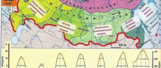
Climate features are formed from indicators of weather regimes of all subjects of the Russian Federation located in this part of Siberia. The Trans-Urals, Omsk, Kemerovo, Novosibirsk and Tomsk regions, as well as the Altai Territory and the Republic of Khakassia lie entirely within the vast expanses of Western Siberia. Partially included here are the Chelyabinsk, Sverdlovsk, Tyumen and Orenburg regions, the Krasnoyarsk Territory, the Republic of Bashkortostan, as well as the Khanty-Mansi Autonomous Okrug and the Yamal-Nenets Autonomous Okrug.
Geographical features
Western Siberia is located from west to east - between the Ural Mountains and the bed of the Yenisei and from north to south - from the Arctic Ocean to the heights of the Kazakh hills.
The total area of the territory is 2451.1 thousand square meters. km. More than 80% of the entire territory is located on the West Siberian Plain, represented by two bowl-shaped flat swampy depressions separated by the Siberian Ridges.
In the southeastern regions, the West Siberian Plain gradually turns into the foothills of Altai, Kuznetsk Alatau, Salair, and Mountain Shoria.
Western Siberia is distinguished by its wealth of water resources. There are many rivers, springs, lakes, and swamps. In the depths there are underground waters and artesian pools. All rivers of Western Siberia belong to the Ob and Kara Sea basin.
The largest rivers:
Are you an expert in this subject area? We invite you to become the author of the Directory Working Conditions
- Irtysh,
- Ob,
- Yenisei.
Smaller rivers are the Pur, Tom, Taz, Katun, Tobol, Chulym, Ket, Nadym, Biya, Vakh, etc.
On the Kulundinskaya, Ishimskaya and Barabinskaya plains there are rivers belonging to the internal drainage basin. Most often they exist during the rainy season and dry up in the summer. Most of the rivers are located in the forest-swamp zone of the Urals.
Precipitation, wind
The climate of Siberia in its western part is not influenced by Atlantic air masses, since this territory is well protected by the Ural Mountains.
From April to September, Western Siberia is dominated by winds blowing from the Arctic Ocean and the east. Arctic air masses come in the form of cyclones and anticyclones, bringing with them coolness.
Dry Asian winds blow from the south and southwest (Uzbekistan, Kazakhstan) and bring clear and frosty weather in cold weather.
The weather in Siberia is stable, so average annual precipitation rarely changes in one direction or another. Approximately 300-600 mm of atmospheric moisture falls per year, with most of it occurring in summer and autumn. This is precipitation in the form of rain. About 100 mm of snow falls almost throughout Western Siberia. Of course, this is an average. For example, in the autonomous okrugs the snow cover reaches a level of 60-80 cm. By comparison, in the Omsk region this mark barely reaches 40 cm.
Climatic conditions
The following natural zones are distinguished on the territory of Western Siberia:
- tundra,
- forest-tundra,
- taiga,
- forest-steppe,
- steppe.
The main territory of Western Siberia has a continental climate (with the exception of the Altai Territory and Altai). As you move deeper into the continent from the ice of the Arctic Ocean, the continental climate increases. Climatic conditions in different parts of the West Siberian Plain can differ significantly. Cyclone activity and high cloudiness are rarely observed on the plain, so solar radiation is especially active.
Arctic air masses have virtually no influence on the climate of Western Siberia. The openness of the territory from the north and south provides opportunities for meridional transport. As a result, temperature fluctuations are negligible.
Finished works on a similar topic
Course work Climatic conditions of Western Siberia 440 ₽ Abstract Climatic conditions of Western Siberia 230 ₽ Test paper Climatic conditions of Western Siberia 240 ₽
Receive completed work or specialist advice on your educational project Find out the cost
A large number of forests, rivers and lakes have a great influence on climatic conditions.
The southern regions of the plain are under the influence of the Asian High, causing little snow and cold winters.
The Kara Sea and peninsulas are an area of influence of low pressure, extending to the Icelandic low.
In the northern regions, the winter temperature is around -40 ºС, in the southern regions – about -15 ºС. The average temperature in summer is +5 ºС (north) and +20 ºС (south). The average annual temperature in the high mountainous regions of the Altai Mountains and the Subpolar Urals is -10 ºС, in the lowlands – up to +5 ºС. The coldest place is the Yamal Peninsula and its northern regions. In summer the temperature here is +4 ºС.
In winter, cold continental air arrives from Central Siberia, cyclonic activity resumes in the north and the temperature regime becomes unstable.
In the interfluve of the Ob and Irtysh on the Vasyugan Plain there are the Vasyugan swamps. These are one of the largest swamps in the world, with a total area of 53 thousand square meters. km. In summer, the Vasyugan swamps provide a cooling effect to the entire territory of the West Siberian Plain.
Temperature
The peculiarities of the climate of Siberia in its western part are that most of the territories there are occupied by swamps. They have a huge impact on temperature conditions and air humidity, which entails a decrease in the influence of the continental climate.
Winter in the north of Western Siberia lasts about nine months, in the center - about seven. The south is a little more fortunate; winter there reigns for five months. These calculations are directly related to the average air temperature in each region. Thus, the southern part of Western Siberia has an average winter temperature of -16°C, and the northern part - -30°C.
Summer is also not pleasant for these regions, since the average temperature ranges from +1°C (in the north) to +20°C (in the south).
The lowest point on the thermometer was recorded at -62 °C in the Vakh River valley.
Climate of the West Siberian Plain
This is an area with a fairly harsh continental climate. The length of the plain in the direction from north to south explains the zonality of the climate and the significant difference between the climatic conditions of the northern and southern lowland regions. Variability in the amount of solar radiation also plays an important role. This also includes the specifics of air mass circulation. Natural conditions even at the same latitude are not significant here, but they differ. The climate of the plain is determined by the presence of a natural barrier - the Urals, which “protects” the territory from warm westerly winds.
Rice. 1. Ural Mountains.
The region lies in an area that is considered a kind of transition area between the following climatic zones:
- moderate continental;
- sharply continental.
Winter is accompanied by low temperatures; there are almost no thaws here. Minimum temperatures in the flat areas are almost similar.
Even near the southern border there are quite severe frosts ranging from minus 50-52°. Almost like in the far north, but the distance between these points is over 2000 km.
Climate of Eastern Siberia
It is located on the territory from the Yenisei to the watershed ridges of the Pacific Ocean. The climate features of Eastern Siberia are determined by its position in the temperate and cold zone. That is why it can be described as harsh and dry. Unlike Western Siberia, the climate type of Eastern Siberia is sharply continental.
Of great importance for natural conditions is the fact that Eastern Siberia is located mainly in elevated and mountainous areas. There are no swamps here, and lowlands are sparse.
The following regions are located in its vastness: Krasnoyarsk and Transbaikal territories, the republics of Yakutia, Tuva, Buryatia, as well as the Irkutsk region. Siberia (Russia) in this part of it is quite harsh, even unpredictable.
Climatic and weather conditions of Eastern Siberia
Eastern Siberia within the Siberian Federal District is the Irkutsk Region, the Republics of Tyva and Buryatia, the Trans-Baikal Territory, as well as the southern part of the Krasnoyarsk Territory. The climate of Eastern Siberia can be described as sharply continental. The average annual temperature is 0°C. In winter, temperatures can reach down to -40°C, but due to the lack of winds, the cold is relatively easily tolerated. In the winter season, in the north of Eastern Siberia you can observe polar nights. Pitch darkness reigns, the sun may not appear for a month, or even more. The climate of Eastern Siberia is characterized by very sunny summers, during which it rarely rains. The maximum temperature in July-August does not reach more than +15°C. Snow begins to fall in October, with a height of about 20-25 centimeters. During the year, precipitation falls in amounts from 300 to 500 mm per year, and in mountainous areas about 900-1000 mm.
Precipitation, wind
In winter, the southern wind direction dominates in Eastern Siberia, bringing with it anticyclones from Asia. The result is the establishment of clear and frosty weather.
In spring and summer, dry Asian air also prevails in Eastern Siberia, but despite this, southern winds often replace air masses from the east carried by sea winds from the Pacific Ocean. And the cold Arctic air is brought here by the northern ones.
The weather in Siberia has decreed that precipitation is distributed unevenly over the area of Eastern Siberia. The smallest number is in Yakutia: only 250-300 mm per year in almost all areas of the republic. The Krasnoyarsk Territory is in some way a record holder. It accounts for the greatest amount of precipitation: from 600-800 mm (west) to 400-500 mm (east). In the rest of Eastern Siberia, the annual amount of moisture that falls is 300-500 mm.
Temperature
The winter months are extremely cold in Eastern Siberia. The temperature amplitude changes sharply depending on the transition of the continental climate in the west to the sharply continental climate of Siberia in the east. If in the south of the Krasnoyarsk Territory the average temperature in the second month of winter is about -18°C, then further north it drops to -28°C, and near the city of Tura it even reaches -36°C.
The north-west of Eastern Siberia has an average January temperature of about -30°C, and on the way to Norilsk and further east it drops to -38°C. Northern Yakutia, which has an extremely low average temperature of -50°C, set the record in 1916, when the thermometer showed -82°C.
In the south and southwest the frosts are noticeably weakening. In Yakutsk itself this is almost unnoticeable, but in the Trans-Baikal Territory and Buryatia the average January temperature rises to -24...-28°C.
The average temperature of the warmest month of the year varies from +1...+7°C in the north of the Krasnoyarsk Territory and the Republic of Yakutia to +8...+14°C in the central part and to +15...+18°C in the south. The zone of mountain ranges and hills, characteristic of such regions as the Irkutsk region, Buryatia, and Trans-Baikal Territory, causes uneven distribution of heat. Thus, significant differences appear in the average monthly temperatures of the spring-summer period. On average, in July the thermometer stops at +13 to +17°C. But in some places the temperature range can be much greater.
Siberia (Russia) in its eastern part is characterized by a cold climate. Winter lasts from 5-6 months (Baikal region) to 7-8 months (the center of Yakutia and the Krasnoyarsk Territory). In the far north it is almost impossible to wait for summer, since winter reigns there for about 11 months. In the central and southern parts of Eastern Siberia, the warm season (including spring and autumn) lasts from 1.5-2 to 4 months.
Main features of Western Siberia
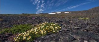
From the above description of the climate, topography and water resources of the region, we can conclude that the continental climate is just the tip of the iceberg. In fact, Western Siberia is a very interesting, beautiful, but at the same time harsh region, the weather in which changes dramatically depending on the distance or proximity to the north and south (Figure 5).
Figure 5. Western Siberia has a harsh climate and amazingly beautiful nature
Since one of the most obvious characteristics of this part of the Siberian region is considered to be a flat, swampy topography, it should be clarified that it was formed not only under the influence of certain geological processes. Atmospheric phenomena, such as cyclones and anticyclones moving from the north and south, also played an important role.
Permafrost
Surprisingly, more than 60% of Russia's area is occupied by permafrost. This is mainly the area of Eastern Siberia and Transbaikalia.
Permafrost is characterized by the fact that the ground never thaws completely. In some places it is frozen a thousand meters down. In Yakutia, a record was recorded for the depth of permafrost - 1370 meters.
In Russia there is a Permafrost Museum with its own dungeon, where you can view this amazing phenomenon.