Why is the climate so diverse?
The Russian Federation extends for many tens of thousands of kilometers, occupying the main part of the ancient continent of Eurasia, it is washed by the waters of three oceans, and the climate is directly related to the colossal number of lakes, rivers and streams. The relief is represented by sharp changes from sky-high peaks to regions located much below sea level. Such large-scale areas simply cannot be the same in terms of various indicators of maximum and minimum temperature, humidity, and the onset of seasons.
Attention! In Russia you can find almost all climatic zones known to science that are characteristic of the globe. First of all, the characteristics of the country’s natural conditions depend on the indicators of geographical extent:
First of all, the characteristics of the country’s natural conditions depend on the indicators of geographical extent:
- from North to South, the icy Arctic zone gradually reaches the sultry subtropical climate of Russia, subtropics with their inherent heat and high humidity in the Sochi resorts of the Black Sea coast,
- The north-west is known for the changeable cool maritime climate of Karelia, Leningrad and Pskov regions,
- advancement to the central regions is characterized by a gradual change from marine to temperate continental climate,
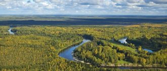
- the vast expanses of Siberia are a typical example of a sharply continental zone with its inherent frosty winters, fairly warm summers and significant temperature differences in the day-night mode; this is the subarctic zone,
- Primorsky Krai and the Far East are the realm of seasonal precipitation, monsoons with elements that are in many ways similar to the features inherent in the subtropics.
Subtropical climate of Russia
Such significant differences in natural conditions are the result of huge distances in the West-East and North-South directions. On the one hand, there are huge regions of Yakut and Tyumen permafrost, where at shallow depths the soil never thaws, even in summer, and on the other, the eternal summer of Sochi, where snow occurs only in the highlands of the Caucasus.
Attention! An equally significant difference is observed when comparing territories located in the interior of the continent and adjacent to the ocean coasts. Geographically, the Russian climate is divided into several classical climatic zones. What is a climatic zone - this is a large part of the globe, located between latitudes, with characteristic climate features that make it possible to distinguish it from other natural zones
Geographically, the Russian climate is divided into several classical climatic zones. What is a climatic zone - this is a large part of the globe, located between latitudes, with characteristic climate features that make it possible to distinguish it from other natural zones.
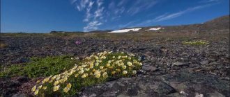
This is interesting: High-altitude (mountain) vegetation zone
Characteristics of the steppe zone
This area is characterized by high average temperatures in summer (22-24°C) and fairly low temperatures in winter (from -4°C to -12°C). The average annual temperature is 5.5°C. Up to 400 mm of precipitation falls annually, and droughts are frequent in summer. The climate varies from temperate continental to sharply continental.
To find out what the steppe looks like during the period of wild flowering, you need to visit it in early spring. At this time, the entire space is covered with a multi-colored carpet of tulips, hyacinths, irises, and poppies. The colorful splendor will last until early summer, when the dry season begins.
The entire steppe zone is conventionally divided into several subgroups depending on the type of vegetation.
There are three subzones:
- meadow,
- cereals,
- southern wormwood-cereals.
The steppe fauna has undergone significant changes over the last century. The reason for this is intensive human economic activity. Some representatives of the animal world have disappeared forever. Bison is a rare animal of the North American prairies, which was almost completely exterminated. Now he is under the protection of the law.
The most common inhabitant of the steppe is the rodent (ground squirrel, jerboa, vole, hamster). Various species of antelope, roe deer, wild horses, and numerous reptiles live here.
Dense grasses are home to many insects that provide food for birds. The most commonly seen bird is the lark. Bustards, eagles, partridges, and cranes are common in the steppe regions. In terms of diversity of species, the fauna of the steppes is very similar to the fauna of semi-deserts and deserts.
Steppe soils have high fertility. In the driest zones they are often saline. In the steppes of temperate latitudes, the soil has the highest percentage of humus content.
Location
In different parts of the world, steppe territories have their own names.
Depending on their geographical location they are called:
- prairies - North America,
- pampas - South America,
- Llanos - tropics,
- savannas - Africa and Australia,
- Tussoki - New Zealand.
Best articles: Red wolf - description, habitat, nutrition, behavior, reproduction and photo of the mountain wolf
The prairies stretch parallel to the Rocky Mountains, from Colorado to Canada.
The Pampas run from Buenos Aires to the center of the South American continent. They are also located in the Parana basin and extend to the mouth of the Rio Negro River.
Llanos are found in Venezuela and the southern regions of the United States.
Savannah is the most characteristic landscape for Africa, occupying most of the continent.
The vast Australian savannas occupy almost the entire north of the continent.
In the space of Eurasia, steppe zones stretch from Hungary to Western Siberia and Kazakhstan. There are these areas in Mongolia, Transbaikalia, in the Tien Shan mountains, Siberia, Central Asia, and Kashgaria.
Types of steppes on the territory of the Russian Federation:
- meadow,
- saline,
- typical,
- dry,
- shrubby.
The Russian Federation has vast steppe expanses that stretch from the Black Sea coast to Altai. In the southern region they extend to the Caucasus Range. Part of the biome is located within the East European Plain, the other is on the West Siberian Plain.
Map and concept of climate zones
Climatic zones are conditionally delimited areas due to different temperature curves, humidity levels, the nature of the climate, the influence of currents, and the length of the seasons. The different influences of ocean currents, topography, and underlying surfaces determine different natural and economic capabilities of the regions.
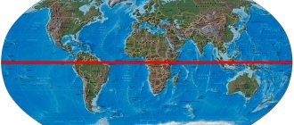
Hot and humid equatorial climate
On both sides of the equator, between 5 and 10 degrees latitude, an equatorial climate has formed. It is characterized by low atmospheric pressure, high air temperatures that hardly change throughout the year (24–28 °C), and heavy precipitation that falls more or less evenly throughout the year (more than 2000 mm). Therefore, in an equatorial climate, the seasons are difficult to distinguish. Updrafts of air dominate here and powerful rain clouds form every afternoon. Daily heavy rains are accompanied by severe thunderstorms.
Due to high temperatures and excess humidity in equatorial climates, equatorial rain forests grow. In equatorial rain forests, crops that require warmth, as well as valuable tree species, are grown. The soils in the rain forests are unsuitable for farming, and more and more forested areas are being cut down to create new fields.
Climate chart for Singapore
Your browser does not support the video tag. Jungle in Belize on the Caribbean Sea, where the weather is hot and humid throughout the year.
The equatorial rain forest in Guadeloupe has a rich species composition
- Air pressure is lower at altitude
- This is caused by global warming
- As warm, moist air rises, it cools, causing water vapor-laden air to cause precipitation.
Arkhangelsk region Karelia Murmansk region
Vologda region Komi Nenets Autonomous Okrug
The climate of the Murmansk region is extremely unique. Snow can fall in almost all months of the year; in December, at the height of the polar night, the air temperature in Murmansk can reach 10 degrees Celsius; Winter thunderstorms on the Barents Sea coast occur almost every year.
Cheap flights to Murmansk
The climate of the Murmansk region is subarctic maritime, with certain continental features. In winter, the distribution of air temperature by month corresponds to the maritime climate. Thus, as a result of cyclonic activity over the waters of the Norwegian and Barents Seas, bringing warm sea air from the Atlantic Ocean, winters in the Murmansk region are relatively warm. The coldest month is February, since this is when the Arctic Ocean cools down to its maximum. However, uncharacteristic of the maritime climate is the fact that the warmest month is July (the air temperature is slightly higher than the mid-latitude one). This is due to the influx of continental warm air masses from the south.
Negative air temperatures in the region are associated with massive intrusions of Arctic air. Thus, against the backdrop of a relatively warm winter, significant cold snaps occur here: down to -40 C° on the coast and below -50° C in areas remote from it. The frost-free period lasts on average 120 days on the coast, and shortens with distance from the coast to 60 days, and on the Khibiny peaks the temperature above 0 °C occurs less than 40 days a year.
Winter lasts 5 months - from November to March. The average monthly air temperature of the coldest winter months (February and January) does not fall below -14°C in the center of the region, and -9°C on the coast of the Barents Sea and -11°C on the coast of the White Sea. Frosty days with average daily temperatures below -20 – -30°C are relatively rare. The number of days with stable frosts is 140-160, and on the Yukspor plateau - up to 190 days. The height of the snow cover varies from 25 to 75 cm, and in the mountains reaches 150-200 cm. The number of days with snowstorms is from 23 to 111; snowstorms usually begin in October and end in May. In the cold season, foggy evaporations form over the non-freezing Kola Bay. Sometimes they are so dense that they reduce visibility to 2–5 m. In summer, fogs often occur on the coasts of the Barents and White Seas when winds blow from the sea.
The average temperature of the warmest month, July, is 9–10°C on the sea coast and in the mountains, and 12–14°C in the rest of the region. The number of hot days in summer with temperatures above 20°C is 6–15 days on the coast of the Barents and White Seas and 16–27 days in the central regions of the region.
Cheap hotels in Murmansk
The first frosts are possible as early as August, and the last ones - at the end of May and June. The duration of the frost-free period on the coast exceeds 200 days, and in other areas of the region it ranges from 50 to 100 days.
The wind regime is extremely diverse. The most “stormy” are about. Kharlov and Dalnie Zelentsy, where on average there are 115-125 days a year with wind speeds of more than 15 meters per second. The “quietest” places - less than 10 days a year with wind speeds of more than 15 meters per second - Kola, Verkhnetulomsky, Pulozero, Yena, Apatity, Polyarnye Zori. Winds from the Atlantic and Barents Sea bring humid air, which contributes to the formation of clouds and precipitation.
The amount of precipitation everywhere exceeds its evaporation rate by approximately 1.4–1.6 times, so the territory of the peninsula experiences excessive moisture and belongs to an area with a cold, humid climate. In Murmansk, the number of days with relative humidity above 80% is 165 days per year. There are an average of 198 cloudy days, only 16 are completely clear. Precipitation falls on almost 150 days a year, the amount of precipitation per year throughout the region is 500-700 mm, in mountainous areas - 900-1300 mm; Most of the precipitation falls in summer.
Due to significant cloudiness, the region receives on average only slightly more than half the amount of solar radiation per year that is possible for a given latitude. And only in the months with little clouds, in March and April, the amount of sunlight is two-thirds of the possible. The average duration of sunshine per year in the region is 1200 hours in the north and 1600 hours in the south. Ultraviolet radiation in the solar spectrum is present only from April to September.
A characteristic feature of the nature of the Murmansk region is the polar night (begins in early December), when the sun at the latitude of Murmansk does not rise above the horizon for 44 days, and the polar day (begins in the second half of May), lasting 61 days. Taking into account twilight and white nights, these periods are much longer.
When to go to the Murmansk region. The timing of your trip to the Murmansk region depends on what you will do there. If your goal is to admire the White Sea and tundra vegetation, hunt and fish, then it is better to go in the summer. The end of July - beginning of September is a great time for hiking. At this time, the berries also ripen, and mushrooms appear in abundance.
If you want to go skiing, then go to the Murmansk region in March - April. These are the clearest months and the peak of the ski season. In open areas, under the influence of wind and sun, a strong crust forms, making skiing easier. During the day it is very warm, but at night the frost sometimes reaches -30°C. When driving in the mountains, it is necessary to take into account that avalanche danger especially increases in spring.
If you dream of looking at the northern lights, then it is more likely to see them on a polar night. It happens irregularly, so it depends on your luck.
Tours to the Arctic – special offers of the day
© Tourex.me
The climate of Karelia is formed under the influence of the North Atlantic and Arctic. West-east transport of air masses predominates, periodically interrupted by winds from northern and southern directions. The passage of cyclones in winter causes thaws, while the passage of cyclones in summer causes a decrease in temperature and heavy precipitation. The length of the territory of Karelia from north to south introduces additional diversity into the course of weather processes. In general, the climate of Karelia is relatively unstable; one type of weather can change abruptly to another. But thanks to the influence of the Atlantic Ocean with its warm Gulf Stream, the average annual air temperature in the republic is on average 10 degrees higher than in more continental areas lying at the same latitude as Karelia. This makes the weather quite comfortable at any time of the year.
Cheap flights to Petrozavodsk
The Karelian winter is long (November - March), cloudy, and snowy, but usually without severe frosts. Snow cover lasts 160 days in the south, 190 in the north. Its average thickness usually does not exceed 50-70 cm, but in heavy snow conditions it can reach up to 110 cm. The coldest months are January and February. And although average monthly air temperatures during this period are relatively high, from – 8 °C in the south to – 14 °C in the Arctic, the “breath of the Arctic” can lower them to minus -36 °C, although thaws also occur. February is characterized by the most unstable weather - this is the month of blizzards and blizzards.
March in Karelia is the sunniest month. In the southern regions, rivers begin to open in mid-March, and at the end of it, lakes. April is coming, and the sky is becoming increasingly cloudy. It is noticeably warmer, sometimes there will be light rain, and fog will appear. By mid-May, ice disappears throughout Karelia.
A characteristic feature of Karelia, as well as the north in general, are changes in the length of daylight hours. It is shortest in December - 6 hours in the south, 4 hours in the Arctic. But already from mid-January the day begins to grow intensively and by June - July the sun shines almost around the clock. This is the time of lyricists and poets - the famous white nights. Due to the long day length, Karelia receives almost as much solar heat in summer as the middle latitudes of Russia.
Summers are short and warm, with plenty of precipitation. Even in June there are sometimes frosts in the republic. Heat is rare and occurs for two to three weeks in the southern regions, and not every year. In the northern regions, heat is extremely rare, and no more than a few days. The warmest and mosquitoiest month is July, with an average monthly temperature of +13 - +14°C, maximum +30 - +36°C.
Cheap hotels in Karelia
Autumn lasts from the second half of August to mid-October. Autumn is the cloudiest period, and daylight hours quickly decrease. In September, the days are noticeably shorter, colder, cloudier, with drizzling rain and fog. Winds intensify and become more constant. However, at the beginning of September there is a blessed time, when the sun shines often, there is little wind, and there is enough heat. It's Indian summer. Unfortunately, it does not last long, 7 - 10 days, and does not happen every year. In the northern regions, snow falls as early as October. From the first days of November, the air temperature drops rapidly, and ice appears on reservoirs. From the second half of November, snow cover sets in everywhere, and winter fully comes into its own.
A characteristic feature of the Republic of Karelia is the large amount of precipitation, both in winter and summer. During the year, 450-600 mm of precipitation falls in Karelia. In terms of their abundance, August is in first place - the most mushroom month.
When to go to the Republic of Karelia. It is best to go to Karelia in summer or winter. From mid-May, navigation opens and the tourist season begins on Valaam and Kizhi - the most famous tourist sites of the republic. Summer is a good time to see the sights, many of which are located in quite wild places. In the summer there are white nights at this latitude; in June the sun does not set 22 hours a day. White nights involve round-the-clock walks around the city and independence from the need to look for parking after dark if you are on a hike. However, you must be prepared for the vagaries of nature. You can get to the region during prolonged rains, which are not uncommon here.
In winter in Karelia it is pleasant to ski, sled, and snowmobile. Ski centers are open. But keep in mind that it can get quite chilly here in January and February.
March is the best time to organize ski trips and ice fishing, but in April you should not go to Karelia, April is a transition month when the sky becomes cloudy and foggy due to warming.
The Vologda region is located in the northern part of the temperate zone. The climate is temperate continental. The continental climate increases eastward. In the Vologda region, the weather is extremely unstable; in general, cloudy and cloudy weather prevails here throughout the year. In the southwest of the region there are up to 200 days of precipitation.
Cheap flights to Cherepovets
The most pronounced two seasons are winter and summer. Winter is long (from November to April) and quite cold (average January temperature is -14°C). In winter, stable snow cover, reaching great thickness, persists for 160-170 days. The beginning of stable snow cover dates back to the beginning - mid-November. The snow cover usually melts in the second half of April. The height of the snow cover is quite large, reaching 60-65 cm in March. The weather in winter is partly cloudy, with prolonged snowfalls typical. In winter, southwesterly winds predominate. At this time of year, especially in February, the strongest winds are observed, which is associated with increased cyclone activity. Summer is short, moderately warm in the south, cool in the north; humid throughout, with high humidity in the west, with frequent precipitation. Relative air humidity in the summer months in the western regions is 75%, in the eastern - 65%. There is more precipitation in summer than in winter; two-thirds of the annual precipitation falls between April and September. The warmest month is July; The average air temperature during this period is 17°C. In summer, the best conditions for recreation are typical for the eastern regions of the region, which are more elevated relative to the adjacent territories, due to an increase in continental climate and a corresponding decrease in precipitation.
Cheap hotels in Cherepovets
Autumn and spring are transitional, short seasons; not clearly expressed. Precipitation in autumn falls mainly in the form of long rains.
When to go to the Vologda region. The best time to travel to the Vologda region is summer or winter. The Vologda region is famous throughout Russia as the birthplace of Father Frost, so the best time to go here is during the New Year and Christmas holidays. Also, thanks to the stable snow cover and the absence of excessive precipitation, it is a good place to engage in winter sports in winter. Summer is good for sightseeing, but it is quite cool. At any time of the year you may be lucky or unlucky with the weather. But, as they say, nature doesn’t have bad weather, only bad clothes.
The climate of the Arkhangelsk region is subarctic, marine. The region is located very close to the Arctic seas and a feature of its climate is the frequent change of air masses associated with the passage of cyclones from the Atlantic Ocean, which cause cloudy weather with precipitation, warm, often with thaws, in winter and cool in summer. There are frequent cases of invasion of air masses from the Arctic, mainly from the Kara Sea, accompanied at all times of the year by cold and dry northeastern winds. In winter, such invasions are accompanied by sharp cold snaps, during which temperatures drop to -55°C.
Cheap flights to Arkhangelsk
The combination of the above factors creates in the Arkhangelsk region more severe climatic conditions in the northern and, especially, northeastern regions, milder in the western, and more continental in the eastern. In most of the area, the coldest month is January, in the extreme northern regions, such as Khodovarikha, it is February, and on the island. New Earth - March. The warmest month is July. In the Far North, there is an exception: on Novaya Zemlya, the warmest month is August.
Winter in the northeast begins at the beginning of October and moves to the southwest, and at the end of October - the first half of November, the winter regime is established throughout the region. In November, snow cover appears, which begins to collapse in April, and in the Far North it can remain until the beginning of July. Snow cover lasts from 237 days in the north to 160 days in the south of the region. Its height by the end of winter reaches 50-60 cm. Severe frosts in the region down to -30 - -40°C are often observed. The absolute minimum temperature recorded over a long-term observation period reaches -54°C, but despite this, thaws are possible in any of the winter months, which are more likely in the west of the region and on the coast of the White Sea and less often in the northeast and east . The reasons for this are the moderating influence of the sea, as well as the frequent passage of cyclones carrying masses of sea air through this area, and the warming influence of the warm Atlantic Gulf Stream, which penetrates far into the Barents Sea.
Winter in the Far North is slightly colder than in the taiga zone, but longer and more severe. The severity of frost is aggravated by high humidity and strong winds. Nowhere in the European North is there such a high frequency of stormy weather as off the coast of the Kanin Peninsula, the islands of Novaya Zemlya and Franz Josef Land. The strength of the wind decreases as you move deeper into the continent, but in the open tundra it remains even more significant. Strong and frequent winds on the coast and in the tundra cause a huge number of days with snowstorms, which, along with fog and snowfall, reduce horizontal visibility. The most intense snowfalls are observed in December – February. In coastal areas, precipitation occurs occasionally in the winter months in the form of sleet or rain. Mostly dry snow falls. From time to time, snowfalls are accompanied by powerful winds and transform into a snowstorm. Such snowstorms are a natural disaster; they cause great harm: they disrupt normal horse-drawn and road traffic.
In the open tundra and on the coast of the Arctic Ocean, drifting snow is often observed; during the winter months, this phenomenon is observed almost once a day. In the southern part of the region, the frequency of snowstorms and drifting snow is less frequent, and they are observed to a greater extent in February. In the second half of winter, under the influence of wind and thaws, an ice crust appears on the snow cover of the tundra and coast, which is a huge obstacle for deer that forage for plant food under the snow.
During the winter months, the sun is low on the horizon. At this time, the polar night is observed in the north of the region; in its extreme south, the length of the day is reduced to 5-6 hours. The influx of solar radiation during this period of the year is insignificant, but it is also spent on radiation and reflection from the snow. Therefore, the earth's surface cools greatly.
At the beginning of March, the length of the day increases noticeably, the sun shines more often and brighter, and at the end of the month in the south of the region (Kargopol, Velsk, Kotlas), the snow begins to melt.
In the tundra, the destruction of the snow cover begins in late April - early May, and the first greenery appears in thawed areas. The end of winter and the beginning of spring in the region are characterized by unstable, variable weather: thaws are replaced by short-term frosts, frosts by warm sunny days. The snow melts and then again covers the ground with a fluffy white blanket. In Naryan-Mar, positive average daily temperatures begin in the second ten days of May. The movement of heat to the north slows down; on the Kanin Peninsula and in the northeast of the Nenets State District, above-zero temperatures are established only in the third ten days of May, and in the Kara and Amderma region - in the second ten days of June. The islands of Novaya Zemlya and Franz Josef Land are partially freed from snow in late June - early July. Inexpensive hotels in Arkhangelsk
There is not enough precipitation in the spring. They fall either in the form of warm rain, which perfectly warms the soil and has a beneficial effect on the development of vegetation, or in the form of wet snow. From time to time, this snow forms an unstable snow cover that quickly melts. A huge amount of heat is spent in the spring on melting snow and ice, on warming and thawing the earth, on warming up cold masses of arctic air, on evaporation, and is also absorbed by clouds.
During the spring and summer months, the region's territory receives a huge amount of solar energy in the form of heat and light. North of the Arctic Circle, from mid-May until almost the end of July, the sun does not set below the horizon. In the south of the region at this time the length of the day significantly exceeds the length of the night. The so-called twilight or white nights are observed here.
Summer in the Far North is cool and unstable, since the prevailing winds from the north during this period bring cold and humid sea polar arctic air. The warmest part of summer with average daily temperatures above 15°C occurs in the southern regions on June 19, at the latitude of Arkhangelsk - Pinega - Leshukonsk - around July 5, in Mezen and on the White Sea coast only individual days are observed with temperatures above 15°C. The average monthly temperature does not reach 15°C. At the beginning of summer, arctic air masses, penetrating deep into the continent, often cause frost in the air and on the earth's surface. Cloudiness is very important for the temperature regime of the territories of the Arkhangelsk region. In autumn and winter, it prevents radiation and greatly contributes to the conservation of heat brought by westerly winds from the Atlantic. Thanks to cloudiness, temperatures, especially in the western regions of the region, are maintained at a high level. In spring and especially in summer, cloudiness significantly reduces the influx of solar energy and prevents the warming of the earth's surface.
Since the beginning of September, huge masses of arctic air have increasingly invaded the region. The temperature drops noticeably and frosts recur. Clear weather at the beginning of autumn gives way to rainy and cloudy weather. The rains are already mostly continuous. At the end of September, a mass flight of birds is observed. Arkhangelsk autumn is short-lived. In October, winter snow falls, and in November a sled track is already established along frozen rivers and lakes. The winter taiga becomes smoother, more spacious, brighter, its swamps become more passable. Daylight hours are reduced to 3-4 hours. The auroras, which began in the last days of August, reach their greatest strength in November - January. Particularly bright and impressive flashes are observed from the shores of the White Sea or from the tops of the Windy Belt.
Over the past 100 years, there has been active warming of the Arctic. This is caused by the strengthening of the western and southwestern winds, as well as the strengthening of the warm Gulf Stream, together with which huge masses of warm water began to flow into the polar seas. Over the past 50 years, a decrease in ice cover in the Arctic seas and melting of glaciers have been noted. Glaciers are melting faster than they are growing, also due to precipitation.
The absence of mountain ranges makes the Arkhangelsk region easily accessible both to cyclones coming from the Atlantic and to cold Arctic air moving from the northeast. Cyclones often invade from the Atlantic Ocean and the western regions of the Barents Sea, bringing with them cloudy weather with precipitation - cool in summer and warm in winter. The passage of cyclones is often accompanied by strong winds. The rear of cyclones passing through the Arkhangelsk region is often invaded by cold air coming from the Arctic to the south. Such an invasion is traditionally accompanied by squally winds and, from time to time, short-term rainfall.
When to go to the Arkhangelsk region. The climatic conditions for traveling in the Arkhangelsk region are harsh. All tourist trips take place during a specific season. The best time to travel to the Arkhangelsk region is summer. In winter it is too cold here, and some settlements are difficult to reach. In winter (from October to April) there is a polar night and there are often frosts down to -40°C. Strong winds and high humidity make winters even more severe. Blizzards, drifting snow, and fogs are not rare phenomena, but the most intense snowfalls, sometimes turning into snowstorms. In the Far North, strong squally winds (Novozemelskaya bora) blow at speeds of more than 50 m/s.
In the second half of April, the snow begins to melt quickly throughout the entire territory. But in mid-May, usually during the opening of the rivers, cold, stormy weather with northwest winds may occur. But those who dare to travel around the region at this time will have the opportunity to admire the breathtaking scenes of friendly ice drift and the spring migration of birds.
From the end of June to mid-August is the height of the summer tourist season. This time usually has the largest number of days of the year with cloudless skies. The arrival of warm weather coincides with the height of the 70-80-day period of white and “pink” northern nights. On such nights (locally called “matte days”) you can safely move along an easy water route or drive along a taiga road. When going to the Arkhangelsk region, you need to stock up on mosquito and gadfly repellents. Here they are found in large numbers. In the summer heat, horses literally go crazy from the bites of gadflies, and local residents often prefer to travel at night. Travel conditions change sharply at the end of August, when morning frosts arrive. The midges immediately disappear, the grass turns yellow, and the first snow may fall. This is how autumn begins. Currants, raspberries, and mushrooms give way in the tourist diet to marsh berries such as lingonberries and cranberries.
The climate of the Nenets Autonomous Okrug is mainly subarctic and continental. It is determined by the presence of permafrost, the proximity of the cold Kara Sea, and the abundance of bays, rivers, swamps and lakes. In general, the district is characterized by long winters (up to 8 months), short summers, strong winds, and small amounts of snow cover. The average annual air temperature is negative; in the Far North it reaches −10 °C. Minimum temperatures in winter drop to −67 °C. In summer, in July, temperatures can rise throughout the entire territory to +30°C. Magnetic storms accompanied by aurora are frequent.
Cheap flights to Naryan-Mar
The territory of the district is located mainly in three climatic zones: Arctic, subarctic and the northern zone of the Western Siberian Lowland. The Arctic climate zone is located in the north of the Nenets Autonomous Okrug and covers the sulfur part of the Gydan Peninsula, the north of the Yamal Peninsula and a group of islands in the Kara Sea. This zone has the harshest climate. The climate of the Arctic part is characterized by long, cold and harsh winters with severe storms, frosts and frequent snowstorms, low rainfall, very short summers (50 days), and heavy fogs. During winter, the temperature is predominantly very low (about -35°C), with an absolute minimum temperature of -67°C.
The subarctic zone occupies the southern part of the Yamal Peninsula. Here the climate is more continental: precipitation is in the form of rain, summer is up to 68 days. The climate of the northern (taiga) strip of the West Siberian Lowland is sharply continental, the average temperature here is higher, summers are quite warm and humid (up to 100 days). In winter, from about the end of November to mid-January, there is a polar night throughout the Autonomous Okrug.
In winter, the Asian anticyclone plays the main role in atmospheric circulation. The number of days with anticyclonic activity increases from north to south. As the Asian anticyclone weakens, the activity of western cyclonic transport increases, which leads to the penetration of transformed air masses from the Atlantic into the territory of the district, accompanied by warming, snowfalls and thaws.
Cheap hotels in Naryan-Mar
Spring and autumn in the region are short, differ little from winter in temperature, the air warms up above zero around the end of May - beginning of June, and by mid-September frosts come again. The beginning of spring is taken to be the dates when average daily temperatures cross 0°C (in the northern taiga May 11-20, in the tundra - later than June 1). Spring is characterized by the return of cold weather and even snowfalls in early June. In May, the northern part of the district is pierced by arctic cold.
The cloudy, cool northern summer lasts about 40-50 days, during which time the soil thaws by about 50 centimeters, and winds often blow. The beginning of summer in the northern taiga occurs on June 10-20, in the forest-tundra on June 21-30. Summer comes to the peninsulas in July. In June - July there is a polar day here. At this time there are a lot of midges and mosquitoes, but after the first frost they disappear. In August-September there are mushrooms, berries, and fish. During the summer period, maximum precipitation falls. In the tundra, maximum precipitation occurs in August.
In September and October there is a gradual decrease in temperature and drizzling rains. In mountainous regions and in the tundra, frosts on the soil are observed as early as the 20th of August. In October it is already cloudy and windy, often raining. Relative humidity in winter is high, its highest value occurs in October and November. In the tundra and forest-tundra, October is a winter month. From November to March there are snowfalls and blizzards. The last winter month is April.
When to go to the Nenets Autonomous Okrug. The best time to travel to the Nenets Autonomous Okrug is summer. At this time, you can visit nature reserves and relax in nature. The best time for hiking, water and other sports will be the end of July and August. August and September are the best time of the year for fishing in the land of amazingly clear rivers, vast expanses of tundra, and fantastically beautiful landscapes of river valleys. By this time, mosquitoes and midges have practically disappeared; the weather is good, there is little rain; the tundra, beginning to turn yellow and red with the first autumn colors, is covered with ripened cloudberries, blueberries and lingonberries; It’s not cold yet, although there are already frosts at night.
Winter is not the best time to travel to the Nenets Autonomous Okrug; it is very cold here, although flashes of the aurora make this region fantastic. But March is the best time for snowmobile racing and reindeer riding, it is the sunniest month of the year, and there is an amazing sunny winter here. March and April are a great time for winter sports.
The geographical location of the Komi Republic in relatively high latitudes, its distance from the warm Atlantic Ocean and the proximity of the vast Asian continent determine the republic's temperate continental climate, harsh in the Subpolar and Arctic regions, milder in the southwestern and southern parts. The large extent of the republic from south to north and from west to east, as well as the diversity of physical and geographical conditions create a significant difference in the climate of its individual regions. Summers are generally short and cool, and cold in northern areas; Winter is snowy, long and frosty. In the north of the republic there is permafrost.
Cheap flights to Syvtyvkar
Winter on the territory of the republic is cold and snowy, and is the longest period. It lasts from November to April-May (average January temperature is -16°C). As you move to the northeast, not only the duration of the cold period increases, but also its severity. On some days, when arctic air invades, the temperature can drop to -55°C in the north and central part, and in the south of the republic to -45°C. In winter, there is a polar night on the territory of the Komi Republic. Late winter/early spring can be very windy. The weather is mostly cloudy throughout the year, so clear days are worth making good use of.
The short summer (June - end of August) is quite cool with an average July temperature of +17°C. In summer, the northern part of the republic enjoys very favorable lighting conditions. North of the Arctic Circle, a polar day occurs, during which the sun does not set below the horizon. Thanks to this, the earth's surface receives a significant amount of solar energy. However, a large amount of solar radiation is reflected by the earth's surface, and is also spent on melting snow, evaporating moisture, and warming the soil, as a result of which the temperature here in summer is low. Even in the summer months there are frosts. In summer, on clear and especially windless days, the soil temperature is usually significantly higher than the air temperature. Even in areas where permafrost already lies at a depth of 1.0-1.5 m, the temperature on the soil surface on some days can reach up to 40°C. In winter, the depth of soil freezing in the south of the republic is about 60 cm, and in the north - more than 100 cm.
Cheap hotels in Syvtyvkar
During the year there is a significant amount of precipitation in excess of evaporation. Frequent passages of western cyclones, bringing moisture from the Atlantic, create conditions for significant amounts of precipitation, the distribution of which over the territory is determined by the terrain and geographical location. A large amount of precipitation with relatively low evaporation leads to excessive moisture in the area, which contributes to the process of peat accumulation. The least rainfall occurs in February and March, and it is very rainy from May to September. Extensive and numerous swamps, as well as a dense river network, contribute to the overall high humidity of the climate.
When to go to the Komi Republic. The Komi Republic has a rather harsh cold climate, and you need to be prepared for this at any time of the year. The best time to travel to the Komi Republic is summer. In summer, crystal clear rivers are excellent for both rafting and fishing. Also, walks through national reserves are very popular. The never-setting sun of the polar day and white nights leave a deep impression. But the weather may be unlucky; be prepared for prolonged rains and night frosts.
In winter, ethnographic tourism peaks here. At this time of year, a huge number of travelers, researchers and local history lovers come to the region. Only in winter can you get acquainted with the life of Izhemsky reindeer herders and watch the reindeer themselves. In winter, the Komi Republic is transformed, the northern territories plunge into the polar night, illuminated by magical flashes of the northern lights. The expanses of winter forest and tundra, large drifts of pure sparkling snow, ice-bound rivers and lakes are an ideal place for lovers of ice fishing, skiing, snowboarding and snowmobiling. But keep in mind that in winter there can be very severe frosts.
Climatic zones of Russia
A climatic zone is a territory in which the same climatic conditions prevail. The division arose due to uneven heating of the Earth's surface by the sun. There are four climatic zones in Russia:
- The first includes the southern regions of the country;
- the second includes the regions of the west, north-west, as well as the Primorsky Territory;
- the third includes Siberia and the Far East;
- The fourth includes the Far North and Yakutia.
Along with them, there is a special zone that includes Chukotka and territories beyond the Arctic Circle.
Features of the natural and climatic conditions of Russia
The natural and climatic conditions of Russia correspond to zonal geographical differences and are as follows:
- most of the country is located within the subarctic and temperate climatic zones and their corresponding natural zones;
- Based on the peculiarities of the geological structure, most of the country is flat, sloping towards the Arctic Ocean and open to its influence throughout the year;
- the territory of Russia is covered with snow in winter;
- Permafrost is widespread in the territory, reaching its greatest thickness in the northeast of the Asian part;
- extreme territories in terms of comfort level are tundra regions of the subarctic climate of flat and mountainous territories, sparsely forested plains, plateaus and mid-mountains, where an artificial environment must be created for human life;
- discomfort territories are represented by cold humid and arid regions - the Ural, Sayano-Khamardaban, Aldan-Dzhugdzhur, Bureinsky mountain areas of tundra and taiga;
- arid discomfort territories - dry steppes, semi-deserts, saline-meadow plains;
- boreal hypocomfortable territories occupy the middle taiga and southern taiga plains with the development of fur trade, centers of agriculture and livestock breeding;
- hypocomfortable semiarid territories occupy the Volga-Caspian, South Ural steppe and dry-steppe plains, dry-steppe plains of Western Siberia, mountain Daurian steppes;
- territories with precomfortable conditions occupy the southern taiga regions and the European part of the country, the forest-steppe of the Southern Urals, Western and Eastern Siberia, and the Far East;
- territories with comfortable conditions occupy the European forest-steppe plain, which has long been densely populated.
Note 3
As a result, it turns out that throughout the vast territory of the country, the most favorable natural and climatic conditions for human life are found only in the steppe zone and especially in the coastal part of the North Caucasus, in the Central Black Earth Region, the Middle Volga region, and also, to a certain extent, in the Southern Urals and Western Siberia.
Need advice on your academic work? Ask a question to the teacher and get an answer in 15 minutes! Ask a Question
Subarctic
The subarctic climate zone includes the area near the Arctic Circle. It is characterized by harsh weather conditions. Winters are cold and long, summers are short and cool, the winds constantly blow and there is high humidity. Permafrost is not found throughout the entire territory; instead, there are a large number of swamps.
In summer, air masses from the temperate zone dominate here, and in winter – arctic ones. The Siberian part of the country differs from the eastern part in its pronounced continentality. The average temperature in July is plus 15 degrees, in January – minus 30 degrees.
The coldest inhabited point on the planet is located in the subarctic zone - the village of Oymyakon. It is located in a depression surrounded on all sides by mountain ranges. The lowest temperature recorded here is minus 70 degrees.
Rice. 2. The coldest point on the planet
This is interesting: Biological resources of the planet
Natural conditions of Russia
Note 1
Natural conditions include: the topography of the territory, its geological features, climate and natural zoning, which are not directly involved in production, but determine the life and economic activities of people.
The elements of the geological structure are platforms and plates, geosynclinal areas. At the base of Russia there are several plates, different in age.
The European part of the country, with a predominance of flat terrain, is located on the Russian Platform, formed billions of years ago.
The Siberian Platform, which occupies the northeast of the country, is much older.
The relatively young West Siberian platform and the lowland of the same name located on it.
Are you an expert in this subject area? We invite you to become the author of the Directory Working Conditions
The platforms are separated by young folded regions - these are geosynclinal belts - Ural-Mongolian, Pacific.
The process of mountain building continues in the belts, so there is increased seismicity and volcanism.
The relief of Russia is mainly flat, represented by lowlands, hills and plateaus - the elevated East European Plain, the saucer-shaped West Siberian Lowland, the high plain - the Central Siberian Plateau.
From the south and east, Russia is bordered by mountain ranges, among which the highest are the Caucasus Mountains, with the Elbrus peak, whose height is 5642 m above sea level. This is the highest point not only of the mountains, but also of the country.
The Old Ural Mountains, stretching almost along the meridian from north to south, are considered the border between two parts of the world - Europe and Asia. The highest point of the Urals is Mount Narodnaya, 1895 m high.
The Kamchatka hills, which periodically erupt lava today, are the easternmost mountains of Russia.
There are no high mountain ranges in the north of the country, so it is open to the penetration of cold arctic air passing far inland, and the penetration of warm air masses in the south and east is prevented by mountain ranges.
Finished works on a similar topic
Course work Natural and climatic conditions of Russia 440 ₽ Abstract Natural and climatic conditions of Russia 250 ₽ Test work Natural and climatic conditions of Russia 200 ₽
Receive completed work or specialist advice on your educational project Find out the cost
Natural mineral resources depend on the geological structure. Minerals of sedimentary origin are associated with platforms and plates, mobile geosynclinal areas and shields have deposits of ore minerals.
The vast territory of Russia has developed a variety of climatic conditions.
The country lies within 3 climatic zones - arctic, subarctic, temperate, which occupies the largest area.
As a result of the large extent of the country from west to east, the temperate climate zone is divided into regions - moderate continental, continental, sharply continental, and monsoon.
Within the subarctic climate zone, there is the pole of cold of the Northern Hemisphere - this is the small Russian village of Oymyakon, where, according to unofficial data, a temperature of 77.8 degrees was recorded in 1938.
The country's climate is characterized by harsh winters and relatively short summers. This leads to insufficient heat, excessive moisture, and the spread of permafrost.
Figure 1. Permafrost. Author24 - online exchange of student work
In the west of Russia, in the area of temperate maritime climate, and in the Far East, in the area of monsoon climate, conditions are more favorable.
In the very south of the East European Plain, the temperate continental climate becomes subtropical, occupying a small area. Winters here are mild, and summers are long and warm.
In general, most of the country's territory has climatic conditions unfavorable for human life and economic activity.
How to determine zoning
To determine the location of any ecosystem, just use an atlas. Based on the world map, you can determine the size and location of any zone on the continents.
Color codes
For convenience, each natural area is marked on the map with its own color.
The generally accepted relationship between the natural complex and its color is as follows:
- equatorial rainforest - the blue-green color of the humid tropics;
- savannas - yellow-green shade of grassy arid plains;
- deserts and semi-deserts - red or orange sand;
- hard-leaved forests and shrubs - the brown shade of the Mediterranean flora;
- steppes and forest-steppes - the yellow color of endless fields drenched in the sun;
- mixed and deciduous forests - light green shade of deciduous trees;
- taiga - the dark green color of dense coniferous forests;
- tundra and forest-tundra - lilac or gray shade of rocky wastelands;
- Arctic and Antarctic desert - light blue or white color of polar ice.
As you can see, for better perception, each landscape is marked with its “native” color: the shade of snow, foliage, grass, sand, etc.
Equatorial rainforests
Their second name is rain forests. They are located mainly in South America, as well as in Africa, Australia and the Greater Sunda Islands. The main condition for their formation is constant and very high humidity (more than 2000 mm of precipitation per year) and a hot climate (20°C and above). They are very rich in vegetation, the forest consists of several tiers and is an impenetrable, dense jungle, which has become home to more than 2/3 of all types of creatures now living on our planet. These rain forests are superior to all other natural areas in the world. The trees remain evergreen, changing foliage gradually and partially. Surprisingly, the soils of humid forests contain little humus.
Read with this
- Subarctic climate
- Climate zones of the earth
- Flora of the May River
- Prohibited signs in the forest for children in pictures
- Devices for cutting bottles: how to quickly and easily cut plastic tapes from bottles (100 photos and videos)
- Plants and animals of mixed forests: typical representatives of flora and fauna
- Types of huts made of branches and their construction
- Jacket fabric taslan (taslan)
- Growing mushrooms at home on the windowsill and balcony
- Decree of the Government of the Russian Federation of June 30, 2007 no. 417 (as amended on April 17, 2019) “on the approval of fire safety rules in forests”
Moderate
Most of the country is located in the temperate climate zone. There is a clear delineation of the seasons here. The natural zone of this belt is taiga. In the temperate climate zone, there are four climatic areas with different characteristics:
- continental;
- moderate continental;
- sharply continental;
- monsoon.
Continental climate is observed in Western Siberia. There is low humidity and moderate rainfall. The average temperature in winter is -19 degrees, in summer – plus 20 degrees.
Temperate continental is the climate of the European part of the country. Features of this climate zone:
- distance from seas and oceans;
- low clouds;
- strong winds.
The territory is represented by different natural zones - from taiga to steppe. This causes a significant difference in humidity - northern areas are characterized by high humidity, and southern areas are characterized by low humidity. The climate of Central Russia is characterized by slight temperature differences. In winter, the average temperature here is minus 10 degrees, and in summer – plus 20 degrees.
A sharply continental climate is characteristic of Eastern Siberia, an area very remote from the oceans. In summer it is cool and humid. In winter it is cold and there is little snow. The average temperature in January is -25 degrees, in July – plus 19 degrees.
Cities with a monsoon climate in Russia are located in the southern part of the Far East. It is characterized by changing weather conditions depending on the circulation of seasonal winds (monsoons) . Winter is cool and wet. Summers are also cool and there is a lot of precipitation. The temperature in winter is -22 degrees, in summer – plus 17 degrees.
Subtropical climate
Characteristic of areas that lie between tropical and temperate climate zones. Tropical air masses dominate in summer and moderate air masses in winter. Significant seasonal differences in air temperature and humidity, especially on continents. As a rule, there is no climatic winter, but spring, summer and autumn are clearly distinguished. Snow showers are possible. Tropical cyclones occur over the oceans.
There are the following subtypes of subtropical climate:
Subtropical Mediterranean climate. Characterized by warm, humid winters and dry, hot summers. The average temperature of the coldest month is about 4 to 12 degrees Celsius, the warmest is about 22-25 degrees. This type of climate is typical for all Mediterranean countries, the Black Sea coast of the Caucasus in the Tuapse-Sochi region, the southern coast of Crimea, as well as cities such as Los Angeles, San Francisco, Sydney, Santiago, etc. Favorable climate for growing tea, citrus fruits and other subtropical crops.
Marine subtropical climate. Tropical air masses dominate in summer, and moderate marine air masses dominate in winter. Winters are warm and humid, and summers are not hot. An example of a marine subtropical climate is New Zealand.
Subtropical desert climate. Tropical air masses dominate in summer, and moderate continental air masses dominate in winter. There is very little precipitation. Summer is very hot, the average temperature of the warmest month sometimes exceeds 30 degrees. Winters are quite warm, but sometimes frosts occur. This type of climate is typical for the southwestern United States, northern regions of Mexico, and some countries of Central Asia (for example, Iran, Afghanistan, Turkmenistan).
Subtropical monsoon climate. Characterized by seasonal changes in winds. In winter, the wind blows from land to sea, and in summer - from sea to land. Summers are hot and humid, winters are dry and cool, and sometimes the average temperature of the coldest month drops below zero. Examples of such a climate: Seoul, Beijing, Washington, Buenos Aires.
Temperate climate. Characteristic of temperate latitudes, approximately from 40 to 65 parallels. Moderate air masses prevail all year round. Intrusions of arctic and tropical air are frequent. Snow cover forms on the continents in winter. As a rule, winter, spring, summer and autumn are clearly defined.
The following subspecies of temperate climates are distinguished:
Temperate maritime climate. Moderate sea air masses reign all year round. Winters are mild and humid, summers are not hot. For example, in London the average temperature in January is 5 degrees Celsius, in July - 18 degrees above zero. This type of climate is typical for the British Isles, most countries of Western Europe, the extreme south of South America, New Zealand, and the island of Tasmania. The area is characterized by mixed forests.
Temperate continental climate. Both maritime and continental temperate air masses dominate. All seasons are clearly expressed. Winter is quite cool and long, the average temperature of the coldest month is almost always below zero (can drop to 16 degrees below zero). Summer is long and warm, even hot. The average temperature of the warmest month ranges from 17 to 24 degrees Celsius. Characterized by natural zones of mixed and deciduous forests, forest-steppes and steppes. This type of climate is typical mainly for the countries of Eastern Europe and most of the European territory of Russia.
Sharply continental climate. Characteristic of most of the territory of Siberia. In winter, areas with a sharply continental climate are dominated by the so-called Siberian anticyclone or Asian maximum. This is a stable field of high pressure that prevents the penetration of cyclones and contributes to a strong cooling of the air. Therefore, winter in Siberia is long (five to eight months) and very cold; in Yakutia the temperature can drop to 60 degrees below zero. Summer is short, but warm, even hot, with frequent showers and thunderstorms. Spring and autumn are short. The natural taiga zone is typical.
Monsoon climate. Characteristic of the Russian Far East, North Korea and the northern part of Japan (Hokkaido Island), as well as China. It is characterized by the fact that in winter the wind blows from land to sea, and in summer - from sea to land. Due to the fact that the above-mentioned Asian High forms over the continent in winter, the winter is clear and quite cold. Summers are quite warm, but humid, and typhoons are frequent. Moreover, summer begins quite late - only at the end of June and ends in September. Spring is characterized by muddy roads, and autumn brings joy with clear and fine days.
Best articles: Flora of North America: features and list of plant species
Subtropical
This belt occupies the European south of Russia. On the territory of our country there is only the northern part of the subtropical zone, so the climate here is more temperate. This is the best region for living and farming. The summers here are quite hot and dry, and the winters are mild and short. Mountain areas are more arid, while the sea is humid and warm.
The Black Sea coast is the only region of the country where even in winter the temperature does not drop below zero, and snow is very rare.
Rice. 3. In Russia, the subtropics occupy a small strip along the Black Sea
Climate of Russian regions
Krasnodar region
The minimum January temperature is 0˚C, the soil does not freeze. The fallen snow melts quickly. Most precipitation falls in the spring and causes numerous floods. Summer temperatures average 30˚C, and drought begins in the second half. Autumn is warm and long.
central Russia
Winter begins at the end of November and lasts until mid-March. Depending on the region, January temperatures range from -12˚C to -25˚C. A lot of snow falls, which melts only with the onset of thaws. Extremely low temperatures occur in January. February is remembered for its winds, often hurricane-force. Heavy snowfalls in the last few years have occurred at the beginning of March.
Nature comes to life in April, but positive temperatures are established only in the next month. In some regions, the threat of frost occurs in early June. Summer is warm and lasts 3 months. Cyclones bring thunderstorms and showers. Night frosts occur as early as September. This month has a lot of rainfall. In October there is a sharp cold snap, leaves fly off the trees, it rains, and sleet may fall.
Karelia
The climate is influenced by 3 neighboring seas; the weather is very changeable throughout the year. The minimum January temperature is -8˚C. There is a lot of snow falling. February weather is changeable: cold snaps are followed by thaws. Spring comes in April, the air warms up to +10˚С during the day. Summer is short; truly warm days occur only in June and July. September is dry and sunny, but frosts are already occurring in some areas. The cold weather finally sets in in October.
Siberia
One of the largest and coldest regions of Russia. Winter has little snow, but very cold. In remote areas, the thermometer shows more than -40˚C. Snowfalls and winds occur infrequently. Snow melts in April, and in a region with permafrost, warmth arrives only in June. Summer temperatures are +20˚С, there is little precipitation. Calendar autumn begins in September, the air cools quickly. By October the rains give way to snow.
Yakutia
The average monthly temperature in January is -35˚C; in the Verkhoyansk region the air cools down to -60˚C. The cold season lasts at least seven months. There is little precipitation, daylight hours last 5 hours. The polar night begins above the Arctic Circle. Spring is short, begins in May, summer lasts 2 months. During white nights the sun does not set for 20 hours. Already in August, rapid cooling begins. By October, the rivers are covered with ice and the snow stops melting.
Far East
The climate is varied, ranging from continental to monsoon. The approximate winter temperature is -24˚C and there is a lot of snow. There is little rainfall in spring. Summer is hot, with high humidity; August is considered a period of prolonged rains. Fogs dominate the Kuril Islands, and white nights begin in Magadan. The beginning of autumn is warm but rainy. The thermometer in mid-October shows -14˚C. In a month, winter frosts arrive.
Most of the country lies in the temperate zone; individual territories have their own climatic characteristics. The heat deficit is felt in almost all zones. Climate has a serious impact on human activity, and it must be taken into account when conducting agriculture, construction, and transport.
Didn't find what you were looking for? Use the site search form
Did you like the article? Leave a comment and share with your friends
Tourist seasons in Russia
There are two main tourist seasons in Russia - during the swimming period in summer and during December-January, which coincide with the ski holidays of winter entertainment lovers. The relatively low season (due to frequent weather “surprises”: chilly winds, uncomfortable temperatures and large amounts of precipitation) falls during the transition seasons - autumn and spring.
- Beach season. The start of the swimming period on the Black Sea is mid-June, when the water warms up to at least +20°C. In mid-summer, the water temperature, depending on the resort, can be +23+25°C. The “velvet” period is considered to be the period in September, when in the Krasnodar Territory you can still swim in water of +23°C, and when the air temperature is +25°C. This season lasts maximum until the third ten days of September, although in some years it was possible to swim even in the first days of October. The Sea of Azov also awaits tourists every year, starting in May. The shallow depth of the Azov Sea allows it to warm up early but cool down just as quickly, therefore the swimming season lasts until the end of August. The shallow sea attracts couples with children to its beaches. One of the features is that the summer season is characterized by a lack of tickets for the required date, if they are purchased in advance, the occupancy rate of hotel rooms is 100%. Early booking required.
- Cruise season. Passenger navigation is carried out along many rivers of Russia, including popular cruises on the Neva, Volga, Lena, Yenisei, and other rivers. The season begins, depending on weather conditions, from the beginning of May and lasts until mid-October.
- Winter season/ski holiday. The Caucasus and Ural Mountains have a network of well-equipped and infrastructurally developed ski resorts. The season begins at the end of October or beginning of November (depending on the stable minus and the density of the snow cover) and lasts until the end of March, sometimes mid-April. The peak of tourist flow also occurs during the New Year and Christmas holidays.
- Thematic tourist seasons: mushroom (mid-April-mid-October), fishing season (all year round), hunting season (March 1-March 16 - for birds, August-December - for game, August-November - for bear, June-January – for wild boar, October-February – for fur-bearing animals).
Best articles: What's in a camel's hump? Water or Fat!