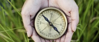
How does a compass work and what does it look like?
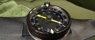
The simplest device is a round body, inside of which there is a magnetized pointer rotating on an axis. A dial with multiple divisions is visible through the transparent top. To protect the glass, some models are equipped with a cover and a small strap for ease of wearing. There is a barely noticeable iron plate (brake) on the side of the case: it is used to fix the arrow. On top of the device there is a sighting device consisting of two protrusions.
Compass device
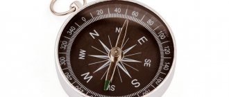
The compass has the following designations: direction north (N), then east (E), south (S), west (W) marked clockwise at regular intervals. Compass directions can be indicated by the corresponding Latin letters N, E, S, W.
Since the circle is divided into 360⁰, there are 90⁰ between the cardinal directions. One division on the compass corresponds to 5⁰, but only those values that are multiples of 20 are labeled. A rotating arrow of two halves is attached to the central part of the dial. Blue points to the north, red to the south. The main points of the dial and the hand are covered with phosphorus. That's why they glow in the dark.
On what principle do compasses work?
Everyone knows that if two magnets are brought close to each other, they will attract on one side and repel on the other. How does a compass work? Likewise. One of the magnets is the planet Earth, the other is a magnetized arrow. Therefore, the latter is always directed to the north.
For your information! Liquid magnetic devices work the same way: their needle floats in a special liquid, which prevents vibrations (while moving).
Why does the compass needle always point north?
Any magnet (made from materials with magnetic characteristics) has 2 poles. Charges of opposite sign are concentrated on them. When magnets touch, single-charged parts repel, and differently-charged parts attract. The largest magnetic charges on planet Earth are concentrated at the poles. That is why the blue compass needle constantly points north. At the same time, the red compass needle points in a southerly direction.
The compass needle always points north
Directional designations
by letters on the compass accepted throughout the world , which are understandable to any inhabitant of the globe, but Russian-language letters are also possible.
- The northern direction is denoted by the Latin letter N (in Latin - north) or the Russian letter - C (that is, “north”).
- The southern direction is shown by the Latin S (in this ancient language - south) or our Yu (that is, “south”).
- The eastern direction is marked with the Latin E (in Latin - east) or the letter B of the Russian alphabet (that is, “east”).
- The Western direction corresponds to the Latin W (west in Latin) or the Russian Z (that is, “west”).
Salting (that is, clockwise) it looks like this: at the top - N (or our C - “es”), further on the right side of the limb is located - E (or our “in” Below - S or our Yu, on the left - W or our Z.
Landmarks for the directions of light, both for maps and globes, and for compasses and terrain, will be placed identically:
- if you position yourself facing north, the north pole will be in front;
- the south pole will be behind;
- the eastern direction will be located on the right hand;
- western - on the left hand.
It is important to understand that the compass, due to the presence of magnetic declination, does not indicate directions one hundred percent correctly! The compass error determines the magnetic declination.
Whereas the instrument indicates geographic light directions, they will actually be offset to some small extent by some amount in degrees . Since the geographic and power poles of the earth do not coincide, it is necessary to make corrections when accurately calculating the azimuth before the upcoming long route. If the expected path is not very long, and the magnetic declination does not exceed 10 degrees, then it makes sense to do without corrections.
Declination is mainly indicated outside the map fields for a specific area. If this is not indicated, it can be found in the reference book - magnetic observatories regularly update the magnetic declination values in degrees that are typical for a particular area.
This is interesting: Methods for determining the sides of the horizon using a compass
The eastern declination is distinguished. It happens when the needle of the device deviates from the north geographic pole to the east, and the westerly direction when the needle deviates to the west.
Please note the following:
- Western declination is indicated by a minus (-);
- eastern - plus (+).
Correction for the declination value, which is calculated from the device (or, in extreme cases, from the reference book), will allow you to establish the true settings of the light directions.
The path is first measured by azimuth, and according to it they move across the terrain. The calculated azimuth angle is the value in degrees obtained between the direction of the path to the desired object and the meridian. Then the azimuth that was found on the map will be true, and the one obtained using a compass will be magnetic.
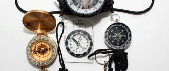
Types of compasses
When choosing a device, you need to take into account your needs, your goals, and the features of the device.
Magnetic
Another name for the most common device is Adrianov, named after the Russian scientist. A magnetic compass consists of a housing, inside of which there is a dial with the sides of the horizon and degrees indicated. After interacting with the earth's magnetic field, an arrow located on the axis shows where north is.
Most often there is air inside the housing, but there may also be a viscous non-freezing liquid. Some models are equipped with clamps to hold the arrow in place when the device is not in use.
Mechanical
The model is especially popular among tourists. A magnetized arrow with a reddish tip points in the direction of the magnetic north pole. With the help of a mechanical compass, as well as a geographical map, it is possible to find out the location of landmarks.
Mechanical compass
For the military
It differs from the previous one in the presence of a lens (magnifying), ruler, and sighting device. The latter helps to view very distant objects. The compass is designed for accurate orientation in field conditions. The main advantages of such a device are high accuracy and durable metal housing.
Geological
A mining device is used to calculate the azimuth of a landmark or route. Its peculiarity is as follows: the graduation of the dial is directed counterclockwise. This compass has a half-limb, a clinometer. With their help, it is possible to find out the angles of incidence of rock layers.
Gyroscopic
Contains a gyroscope - a special device capable of responding to changes in orientation angle. The compass is widely used in aviation and navigation. It shows the geographic pole with high accuracy. The indicators of such a device do not go astray even when rocking.
Compass for military
Gyroscopic compass
Geological compass
Astronomical
Used to determine cardinal directions using stars and the moon. However, even the high accuracy of the readings did not bring popularity to the device. This is explained by the complete uselessness of such a device during daylight hours.
For orienteering
Athletes must be able to use orientation devices and understand the symbols on a geographical map. Choosing a compass for orienteering is not an easy procedure. The most suitable model must meet the following requirements: the needle stabilizes as quickly as possible, the compact device (light weight) fits in the hand and does not slip.
Astronomical compass
Orienteering compass
Electronic
A modern compass with magnetized sensors is accurate and performs additional functions. In addition to determining the coordinates, it remembers the route mileage and information about the stages of movement. It is extremely convenient to save a starting point on the terrain, then move on. Such models are in demand among tourists and military personnel.
Important! When purchasing an electronic device, you need to remember: the battery charge lasts about three days. Therefore, on a long hiking trip, it is recommended to take a regular magnetic device.
Radio compass (ARC)
An automatic on-board radio direction finder is used to navigate aircraft during flights. It shows the direction to the object that emits radio waves. Having tuned to the desired frequency, the device provides the required information.
The radio compass determines the location of the radio station and gives the correct heading regardless of the time of day or weather.
Radio compass
Travel electronic compass
It is considered the best option for a short hike. In addition, it shows the exact time and performs many other tasks. Such a device does not contain a magnetized needle; the location of the cardinal points is determined by electronic circuits.
GPS and Glonass
Satellites emit signals that are then picked up by electronic systems. Navigators decipher the information received and provide coordinates. In contrast to magnetic devices, they perfectly perform their tasks in conditions of limited visibility, in the absence of noticeable landmarks. When avoiding obstacles, the GPS device must be adjusted to a changed section of the route. The required direction will definitely be automatic.
Travel electronic compass
GPS and Glonass
Electromagnetic
A device with straps (for convenient attachment to the hand) is not very popular. It is made similarly to a magnetic one, but the position of the needle is determined by electronic components. Then the processed information appears on the screen. This device is more suitable for hunting and fishing.
The functionality of the electromagnetic device depends on the battery charge. Therefore, you should not rely on it on a long journey.
Liquid
The structure is no different from magnetic. However, inside the flask, instead of air, there is a non-freezing viscous liquid. Thanks to the last arrow of such a device, you can calm down almost instantly.
The liquid device is not intended for walking. It is most often used in orienteering competitions. Such a device is accurate, fast, and extremely convenient, which is important for athletes.
Liquid compass
Compass program on Android and iPhone
A smartphone is an advanced phone that performs many functions. Among the built-in applications there is always a navigator, compass, and maps. The latter allow tourists to easily navigate unknown territory. Determination of the sides of the horizon occurs thanks to satellite communications. Modern phones also provide an SOS call function. The main disadvantage of the programs is that their operation depends on the charge of the gadget.
The above option is suitable for those who travel to neighboring cities or abroad. It is important for tourists, sailors, and military personnel to be able to read maps and use magnetic and electromagnetic devices.
Compass program on Android and iPhone
How to navigate with a compass
Before performing compass orientation, it is important to move away from electronics and metal accumulations. Then you need to remove the arrow from the holder. After performing circular movements, it will stabilize and point north.
Then you need to determine the parking location on the map, mark the final destination, and draw up a detailed route. To do this, the north direction of the map and the device is compared, and the required course is indicated.
Designation of the cardinal directions on the compass
In the generally accepted system of signs, the first letters of the names of the cardinal directions are used: N - north, E - east, S - south, W - west. You can often see English letters on the instrument dial: N (North), E (East), S (South), W (West).
Designation of the cardinal directions on the compass
To make it as easy as possible for tourists to determine the cardinal directions using a compass, additional directions are often indicated on the dial: NW, NE, WY, SE.
How to calculate cardinal directions
It is accepted that on all maps north is at the top, south is at the bottom, west is on the left, and east is on the right. The location of the sides of the horizon can be calculated approximately.
In a compass, the needle is not fixed: its magnetized part (usually blue) always points north. However, there are instrument models in which the needle is painted a different color. To avoid errors during orientation, you need to determine the magnetized half in practice. This will further check the functionality of the compass.
To do this, you need to go outside with the device at noon. At this time, the sun is located closer to the south. The part of the arrow that turns towards the sun will point south.
How to find azimuth using a compass
By definition, azimuth is the angle between the direction north and the destination. It is measured in degrees, and its value can range from 0 to 360°.
How to determine:
- Place the device horizontally.
- Carefully remove the arrow from the retainer.
- After stabilization, align the latter with the symbol C on the dial.
- Select your destination.
- Calculate the given angle.
- Strictly follow the information received.
If the tourist does not deviate from the correct course, he will accurately achieve his goal. To return to the starting point, a reverse azimuth is used, the direction of movement will be the opposite.
Finding azimuth using a compass
How to use a compass in the forest without a map
The following orienteering technique is suitable for tourists who do not like to do calculations, as well as hunters and mushroom pickers.
Step-by-step instruction:
- The starting point will be a significant object (preferably elongated): a familiar path, stream, road. The cardinal directions are used as a reference point.
- Stand with your back to the starting place, facing the final destination.
- Using a compass, determine the direction (for example, southwest), move strictly along it, carefully follow the arrow.
If you need to return to the starting point, you need to go in the opposite direction (northeast).
Using a compass without a map in the forest
Orientation by compass and map
When traveling long distances, it is recommended to take a compass, map, pencil, and ruler. Sometimes tourists explore unfamiliar areas in advance.
Procedure:
- Mark the planned places of visit on the map.
- Activate the compass needle and align its blue half with the north on the map.
- Connect the first stopping point with the middle of the limb, calculate the angle between the direction to the north and the desired object, and record the reverse azimuth in the records.
- Perform a similar procedure with all intermediate points on the route.
- On the way, it is important to periodically check previously received data.
If you have the correct calculations, the likelihood of getting lost during a hike is minimal.
Orientation by compass and map
How to determine cardinal directions
The compass mechanism is simple and ingenious - a magnetized needle, placed in a case under transparent glass in the center of the dial (dial), when released from the stopper, will show the north pole with its north tail, and the south pole, respectively, with its south tail. The limb is marked with the cardinal directions using letters. If the device is domestic, then the letters will be taken from the Russian alphabet, but if the device was not made in our country, then in accordance with international designations, Latin.
The dial has a circular scale of 360 degrees, which is divided into 4 identical sectors, increasing clockwise. The size of the scale step for an individual device may be different, however, in any case, any of the directions of light is delineated by certain degrees:
- north is marked 0 degrees,
- south - 180 degrees,
- east - 90 degrees,
- west - 270 degrees.
This is interesting: How to determine azimuth from a map
Determining the cardinal directions using the device is quite simple , but in order for the mechanism to indicate the correct direction, a number of simple rules must be followed.
The device must be given an exact horizontal position - for this it is either placed on a flat surface or held with an open palm slightly below chest level.
There should be no magnetic interference nearby, such as:
- accumulations of metal,
- railway track,
- power lines,
- as well as other similar interference.
If these requirements are not met, the arrow will show the wrong direction.
As soon as the compass is in the correct position, you will need to release the lock , which plays the role of a brake or stopper.
The released arrow, having wavered, will take a firm position when the specially marked northern tip indicates north, and the opposite one indicates south.
After this, you need to align the tips of the arrow with the cardinal directions marked on the dial.
In order to determine a route on the ground, it is necessary to correctly select the desired direction of the path, corresponding to the desired part of the map or outline.
Specifics of using compasses
The way some devices operate is slightly different. You should pay attention to the following devices:
- With an arrow glued to the dial. In such cases, the latter does not need to be combined with the north. However, as many tourists note, such a device is slower in operation than conventional models.
- With a small mirror. It helps you control the values shown by the needle on the scale.
- Transparent. It’s much more convenient when working with maps and simplifies the process of navigating the terrain.
- Liquid. They stabilize faster after sudden movements.
Important! There are also military and artillery compasses, which differ significantly from tourist compasses: the body is made of shock-resistant material, the arrow instantly takes the desired position.
Transparent compass
Compass errors, magnetic declination
Back in the 19th century, it was proven that the geographic poles do not coincide with the magnetic ones. In the north, the distance between the latter is about 700 miles, in the south – 1500. These values are taken into account on all maps and in modern electronic devices.
Magnetic declination is the angle between two meridians (geographical, magnetic) at a specific point on the Earth, showing the difference between the compass readings and the true north direction.
In most cases, the discrepancies are insignificant, but sometimes they can reach 25°.
Since planet Earth is in constant motion, the layers of the earth's crust shift, the values of the magnetic declination change. Periodically updating maps will help avoid errors in calculations.
What to do if the compass is broken
If the device breaks down, do not worry too much. It is possible to make it yourself using available materials.
Among them are suitable:
- needle;
- bottom of the bottle (plastic);
- a piece of bark, cork;
- battery, magnet.
Compass from improvised means
Preparation method:
- Make a shallow trench in the bark or cork.
- Magnetize the needle. Place one end of the latter on a magnet, and the other on a burning match. This procedure will lead to demagnetization of the other half. Second option: take the needle with an insulated object and apply it to the battery poles. The edge touched by the negative value will subsequently point north.
- Place the magnetized needle in the gutter and lower it into the lid with water.
Attention! After completing several rotations, the created arrow will point to the north direction.
When is a compass better than a navigator?
Due to the rapid development of technology, new gadgets come on sale every day. GPS navigators occupy a place of honor among them. They contain a geographic map and a route planning function. Satellite communication allows you to accurately determine the location of a tourist and accompanies him along the way.
The main disadvantage of a GPS navigator is the battery, which requires periodic recharging. If it fails, the tourist will not be able to use the device (obtain the required data).
Using a tourist compass and a topographic map is much safer. Under natural conditions, their readings are accurate and do not depend on the condition of the battery. When orienting, it is only important to carry out all measurements sequentially, according to the rules.
The disadvantage of the navigator is that the battery drains at the most inopportune moment
Criteria for choosing compasses
- Size. One of the most important parameters. It is important even if a short hike into the forest or other unfamiliar area is planned. If you are planning a long outing, and you will need to carry a heavy backpack with all the necessary equipment, every gram of luggage counts. And there may not be enough free pockets. The optimal size is considered to be one that allows you to place the device in the palm of your hand.
- Shockproof housing. This parameter is important if you are planning not an ordinary trip to the forest to pick mushrooms, but a long outing with active pastime.
- Availability of water resistance. This criterion is of interest to fans of water sports. If you don’t plan to dive under water, it makes no sense to overpay for this function.
- Availability of backlight. If you are planning night outings into nature, this function will not be superfluous, since you may not always have a flashlight or a backlit smartphone at hand, and it will be difficult to determine the cardinal directions. There are also models with fluorescent coating on sale. It accumulates light and displays it in the dark for some time.
- Availability of a navigator. It is important for long hikes or trips on a bicycle, ATV, etc. Most professional gadgets are equipped with GPS sensors, making it easier for the user to determine location.
- Built-in barometer and altimeter. This criterion will be of interest to lovers of mountain hikes. The first device determines atmospheric pressure, changes in which in one direction or another indicate a change in weather. The second is capable of determining the height above sea level, which makes it possible to measure the distance from the foot of the mountain.
Among the general recommendations for choosing a device, one can highlight advice on purchasing navigation devices only from companies that manufacture measuring gadgets. Manufacturers who have been on the market for a long time have honed their skills in making compasses, eliminated all possible shortcomings, and their products will not fail at the most inopportune moment.
Recommendations for use
A compass is a device that requires testing for serviceability upon purchase. Particular attention should be paid to the speed of needle stabilization. When searching for the north for a relatively long time, it is better to abandon the device.
Having decided on the model, it is important to carefully study the attached instructions and learn how to use it. Further actions:
- Calibrate correctly.
- Practice: use the device in a familiar area.
- If the purchased device is electronic, buy a backup battery.
- When planning a route and determining the duration of a trip, you need to take into account the degree of energy consumption of an electrical appliance.
Important! With prolonged use, some parts of the compass may become slightly deformed. Therefore, it is recommended to periodically check the device for serviceability.
Tips for choosing a convenient model
Due to the availability of a huge variety of compasses on sale, the question arises: which device to buy so that it is reliable, maximally functional, easy to use, and suitable for certain purposes.
For cars and motorcycles
For a motorcycle rally or car trip to unknown places, it is recommended to focus on electronic models of compasses. They guarantee accurate data. In addition, the operation of such devices will not be affected by metal parts of vehicles. This means that the functionality of the devices will not be affected. Recharging electrical appliances is done by using the energy of a running vehicle.
For bicycles
Cycling trips usually take place near populated areas. The best option in such cases would be a liquid compass. If you hang it on your wrist using a neck cord, you can constantly monitor your location without stopping your movement. When planning a bike ride to a remote city, it is better to take care of a spare electronic device.
A wrist compass is great for cyclists
For hiking
You can calmly walk around the territory of a huge nearby park using the simplest magnetic compass. If such walks take place with children, then it is recommended to purchase a children's model that is worn on the arm. In this way, the younger generation can be familiarized with the rules for using the device and instill orientation skills in the form of a game.
For sports
To practice orienteering, it is important to have special equipment. For such purposes, a liquid device is best suited. It is convenient, works quickly, and gives accurate readings.
Orienteering
Attention! As a general rule, competitors are prohibited from using electronic devices at orienteering competitions.
What to look for when choosing
When choosing a compass, it is important to be able to determine the most suitable device for yourself. Experienced travelers recommend focusing on:
- Case size and weight.
- Protection from moisture.
- Resistance to external mechanical influence.
- Availability of backlight.
- Functionality.
- The presence of a gyroscope, barometer, altimeter.
After analyzing the points described above and understanding the characteristics of a particular device, you can easily determine how suitable it is for use in specific conditions. With the right choice, a person will be able to easily determine the cardinal directions on a compass, which means he will not get lost and will quickly reach his tourist destination.
Calculating azimuth
The map shows the true meridians meeting at the point of the true geographic pole. In this regard, the angle between the meridian that goes north and the course of the path obtained from the map will differ from the angle found using the instrument , since the compass needle is located along the magnetic meridian, and not at all geographical.
If there is an eastern magnetic declination in this area, then its value must be subtracted from the azimuth, which was obtained using a compass on the spot, so that its value converges with the true azimuth, which is found on the map. That's why it is indicated by the sign “—” (minus).
If a western deviation is observed in this area, then its length must be added to the magnetic azimuth in order to obtain the true value. That's why it's marked with a + (plus) sign.
You can be calm about the calculations , because corrections for magnetic declination provide a guarantee that the trip will take place within the planned boundaries and will coincide with the true geographical indicators, and the route will not deviate from the map.
Even though progress spoils human society with digital navigation techniques, the classic compass with a magnetized needle is as popular and reliable as ever. Its operation does not require power, the presence of a satellite or a cellular tower, which means that this device will never fail: it will not break, will not run out of power, etc. And even a child can determine the cardinal directions on the compass.
Interesting facts about the compass
Before getting its modern look, the familiar compass went through a long process of improvement. In this regard, there are many amazing facts left in history that have survived to our time:
- The first needle made for the Chinese device was shaped like a tadpole.
- Fleur-de-lis (French for "lily flower") is a frequently used symbol to indicate north on a compass.
- During World War II, compasses (in the form of blades or buttons) were secretly delivered to prisoners of war in camps to help them escape.
- The Qibla compass is a navigational device used by Muslims. It shows the direction to the city of Mecca, where believers turn to perform the ritual of prayer.
- Old Arabic devices had 32 cardinal points on the dial, but modern ones are marked in degrees.
- In current liquid devices, mineral oil, ethyl alcohol, and purified kerosene are used as liquid.
- In China, the compass was initially used not for navigation, but for building houses according to Feng Shui.
- In aviation, a navigation device indicates the course only on straight sections (for example, from Asia to America). During the flight, the pilots are guided by air traffic controllers.
The compass is an amazing device that has undergone minor changes since its creation. Once upon a time, thanks to such an important invention, new lands were discovered: sailors dared to go out to the open sea. Today it is widely used in various fields of human activity. This is exactly the case when an ancient discovery has not lost its relevance to this day.
Did you learn something new? Share it in the comments!