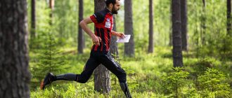
Orienteering is a popular sport that requires not only endurance and speed, as in running, but also the ability to think logically and navigate the terrain. In Scandinavian countries, orienteering competitions attract thousands of participants of different ages and skill levels. In our country, competitions are not yet so common among amateurs, but they are no less interesting.
In this article we will tell you what orienteering is, what skills an athlete will need to take part in a mass start, and why runners should definitely try this sport.
What is orienteering
Orienteering begins at the moment when, at a briefing, you are given a map of the area and a route legend, and the organizer talks about the features of the training ground. Somewhere on this training ground there are checkpoints (hereinafter referred to as CP), which you have to find, record your location there and return to the starting point before the set time expires.
You will have to walk a lot, often on difficult terrain, read a map, think logically, calculate your strength, make mistakes and correct mistakes - and, of course, be proud of yourself after each success. All this is orienteering. Let's take a closer look at this popular sport.
Story
People were good at determining their location on the ground and calculating the direction to the desired point even before our era. These skills were necessary to wage war, build sea and land trade routes, and develop new territories.
As a sport, orienteering arose quite recently, at the end of the 19th century. Its homeland is Scandinavia. Different sources indicate different data: according to some, the very first amateur orienteering competitions took place in May 1897 near the Norwegian city of Bergen; according to others, it was October of the same year, but already in the city of Oslo.
One thing is certain - orienteering was born from the exercises of army garrisons at military training grounds, and later ordinary amateurs began to adopt the experience of the military.
The father of orienteering is considered to be the Swede Ernst Killander, a major, a participant in the First World War, who invented cross-country competitions. It was he who came up with the idea of orienteering in unfamiliar terrain in a natural environment, and he was the first to suggest that each participant himself lay out his own route to the desired point.
Sweden held its first orienteering championship in 1923. Other countries picked up the Scandinavian invention and introduced it into their own countries. In 1960, athletes from seven countries took part in the international championship in Stockholm.
Training plans for marathon and half marathon. and start preparing today.
This sport was gaining popularity at such a pace that the very next year after the first championship, the International Orienteering Federation was founded. At that time, it included 10 countries: Norway, Sweden, Finland, Denmark, East Germany and Germany, Switzerland, Bulgaria, Czechoslovakia and Hungary.
Today, 80 countries have representation in the federation. In 1977, the International Olympic Committee recognized the federation, but orienteering was not included in the Games program. But it got into the World Games, which are held in the same way as the Olympics, once every 4 years and are, let’s say, an alternative to them - in the World Games athletes compete in those sports that are not included in the Olympics.
In the USSR, the first orienteering competition took place in 1939 near Leningrad. Several teams navigated unfamiliar terrain at night using only a compass. Some sources say that the participants carried rifles, gas masks and duffel bags weighing 8 kg.
The USSR national team entered the international arena in 1965, the best result was shown by participant L. Barisa, who took 10th place out of 40. Several decades have passed since that moment, and orienteering has not only not lost, but even strengthened its position among lovers of outdoor activities .
Russia also received worthy representation among other countries - in 2011, Paralympian Dmitry Kucherenko became the first Russian orienteer to win the World Trail Orienteering Championship.
History of orienteering
Orienteering as a sport originated in the Scandinavian countries at the end of the 19th century. At first, only military personnel participated in the competition. The first civilian competitions were held in Norway in 1897. The basic principles of orienteering appeared: competition rules, types of distances, choice of landmarks for setting checkpoints, age categories of participants.
At the beginning of the 20th century, orienteering spread throughout the USSR and European countries, and national championships began to be held. In 1961, the International Orienteering Federation was founded in Denmark, which united national orienteering federations.
In the USSR, the first orienteering competitions were held in 1939. Interestingly, it was a night start, where the participants covered a distance of 20-25 km; they only had to find one checkpoint. At the beginning of the development of orienteering in the USSR, there was the concept of “control load” - the weight that the athlete was allowed to carry, different for men and women. Back then, orienteering was considered a form of tourism, not a sport. Over the years, orienteering developed, and all-Union championships began to be held. After the collapse of the Soviet Union, Russia became a member of the International Orienteering Federation.
At the beginning of the development of orienteering, the Scandinavian countries were the leaders. Later they were joined by Russia and the CIS countries. Russian athletes regularly win medals at international championships. In many cities of Russia, the “Russian Azimuth” launch is regularly held.
Varieties
Orienteering has five main types of competitions.
Orientation in a given direction
The participant receives a clear order of control points and must take them in the specified sequence. At the same time, he can plot any route that is comfortable for him from point to point.
Source: orienteering.sport
Orientation on a marked route
In this case, the checkpoints are not marked on the map; the participant only knows the starting location. Moving with a map in his hands along a marked route, he encounters a checkpoint and must mark this place on the map with a needle or a special composter.
Orientation by choice
The participant receives a card with the CP marked, and then there are two possible scenarios for the development of events. Either he is given a control time during which he must manage to take the largest number of control points at a distance - or he is offered to take a certain number of control points from those installed at the training ground.
This implies that it will be impossible to bypass them all. In both cases, the one who scores the most points wins.
Rogaine
This competition format is becoming more popular year after year. If ordinary orienteering involves competition in a short period of time, then rogaining is a multi-hour adventure with a map and compass in hand, where checkpoints are marked on the map, and the participants build a route to their taste, focusing on the “value” of the checkpoint, control time and their own strength .
Read on the topic: Rogaining: rules of participation, distances, equipment
Trail orientation
In all of the above types, the emphasis is on the speed of the route. Trail orientation is focused on understanding the situation on the ground and reproducing it on the map. The participant must give the greatest number of correct answers.
Trail orienteering originally emerged as a sport for people with limited mobility.
In addition, orienteering starts differ in other parameters:
- by time of day: day and night,
- by format (individual, mass and relay starts),
- by team composition (individual races, men's and women's teams, as well as mixed).
- by the nature of the distance: walking, running, cycling and even skiing.
The concept and essence of orientation by choice
Orientation by choice, in contrast to orienteering in a given direction, differs in that it provides competition participants with greater freedom of action. This is due to the fact that when completing a distance in a given direction, participants cannot proceed to the next task if the previous one has not been completed. In addition, the route is marked and has a beginning and an end. Thus, it is designed for a certain level of training of participants. Such routes are not always accessible to beginners and participants with a low level of training. Orientation by choice allows participants to independently choose the distance according to their own strengths.
Are you an expert in this subject area? We invite you to become the author of the Directory Working Conditions
It should be noted that, despite the independent choice of the distance to travel, it is important to meet the allotted time, otherwise participants may receive penalty points. This keeps beginners in the start-finish area, as a result of which in orienteering by choice it is less necessary to search for lost participants.
Note 1
Another attractive thing about selective competitions is that they require less time and effort to prepare, conduct and score results.
Features of the distance
The orienteering competition site must meet several conditions, regardless of the nature and format of the race.
The terrain must be passable for all participants, especially for ski and bicycle starts. The terrain must be accessible to vehicles.
The control points are not collected in one place, but they are not scattered at an even distance from the start and from each other. The interest is to create the most varied segments between control points. In some places they will be short, but difficult to overcome, in others they will be long and uncomplicated. The most interesting are the distances with varying technical difficulties and constant changes of directions.
The organizers plan the location of the checkpoints in such a way that there are several access options to each of them. This eliminates the joint actions of several teams to search for a checkpoint, and participants have the opportunity to build their own unique route.
Organizers must provide safety for participants along the route. Control points are not installed in private or protected areas where access is prohibited, and are not installed in places where access may be associated with a risk to health and life.
Almost always at an orienteering competition there is a choice of distances - from the easiest for beginners to the hardcore, which will be chosen by experienced amateurs.
Sprint
The main element is speed. Moreover, the speed of both running and thinking. In the sprint there will be no steep climbs and far away checkpoints. The main task of the athlete is to choose the optimal path to the point and reach it as soon as possible. The time to complete the distance is a matter of minutes, usually less than half an hour.
Classic distance
The emphasis is on finding the checkpoint, so at such a distance it is necessary to use the map often and constantly change the direction of movement. CPs are located in non-obvious places, participants will have to use speed, attentiveness and technical skills to overcome obstacles.
Long distance
The main thing is the choice of route. It is necessary to correctly calculate the forces and be able to navigate a wide space and over a long period of time. Running from point to point on this type of distance can be several kilometers.
Marathon
The peculiarity of this distance is the long route between points for any choice of path and the technical complexity of many stages. A competitor is required to have endurance, composure and the ability to continuously make decisions over a long period of time. The name of the distance does not imply that participants will have to run 42.2 km - they usually run up to 30 km.
Relay race
This distance is similar to a sprint with high speed and relatively short distances between checkpoints. However, it should be taken into account that each team member will have to go through it alone. Thanks to head-to-head and sometimes contact wrestling with opponents, this orienteering discipline is considered the most spectacular.
Jukola is the world's largest relay orienteering competition
Distance planning during optional orientation
When planning a distance during orientation, several options can be used.
Option 1 . The number of points is determined by the difficulty of finding a control point (hereinafter referred to as CP). The further the checkpoint is located from the start, and the more difficult it is to find, the more points participants receive when finding it. The speed of finding the control point is also taken into account. With such an organization of the route, it is more logical to place the start and finish in the center of the search area, since there will be more options for the movement of participants.
Finished works on a similar topic
Coursework Optional orientation 430 ₽ Essay Optional orientation 230 ₽ Test paper Optional orientation 200 ₽
Receive completed work or specialist advice on your educational project Find out the cost
The disadvantage of organizing the route, therefore, is that an unprepared participant or a beginner prefers to choose a control point worth 3 points, which is located on the edge of the map, rather than 2-3 control points of one point each in the start area. As a result, such participants create confusion and often join the ranks of lost participants.
Option 2 . The system, which has proven itself over many years of use, is that all CPs have equal scores, and the result of the competition is determined by the number of CPs taken. When organizing such a distance, the start and finish are located at a considerable distance from each other, over 1 km, and along the way from the start, a group of checkpoints is visible on the map, which is a guide to the finish.
Participants who are poorly prepared or are beginners already from the start go through a mandatory checkpoint, which is located at the beginning of the finishing corridor, which ensures that they have a certain result and increases their motivation for further training.
Some checkpoints are located deep in the track; only well-prepared participants can find them.
The difficulty in conducting optional orienteering is that some participants, especially beginners, often do not have a watch, and therefore it is difficult to set a target time for completing the distance. To get out of this situation, it is necessary to set a time that is more or less familiar to the participants, and they can navigate it according to their own feelings, for example, 45 minutes is the time of a school lesson.
A signal can also be used that will serve as the end of the distance time (flare, megaphone, car horn, etc.). The signal can be given 2-3 times. The first signal means that there are 5 minutes left until the end of time, the second signal means that the competition is over.
The start for participants in orienteering competitions can be given either in general or for each group (participant) separately. Most often, separate signals are given for teams of girls and boys, as well as for teams of different ages. For example, the first start of the race - one boy from each team starts, after 3-5 minutes - one girl from each team, etc.
It is most logical to familiarize yourself with the distance map a few minutes before the start, so that participants can not only familiarize themselves with it, but also outline their own route along the route. Such familiarization with the map guarantees that at the start the participants will not “follow” the more experienced one, but will try to work independently, by building their own rational route.
Rules
Both participants and organizers must follow the rules in orienteering - each has their own rules. Let's list the most basic ones.
The organizers are obliged:
- Provide participants with a detailed map of the area, a route legend and a route book, if it is included in the competition. The value of the control points should be indicated on the map: more points are given for those that are difficult to reach than for those that are easy and closely located.
- Make the control panels visible and securely attach them to the object. Usually the control panel has a color contrasting with the surrounding environment - red, orange, so that it is clearly visible from afar. They are most often attached with any adhesive tape to trees and other large stationary objects, and in the text of the CP, the organizers additionally ask “not to tear them down until such and such a date, competitions are underway.”
- At the briefing, talk about the features of the training ground and warn about possible difficulties during the route.
- Ensure the safety of participants at the start and finish.
The organizers have the right:
- Disqualify a participant or team for unsportsmanlike behavior or gross violation of competition rules.
- Award winners in different categories.
- Determine the control time of your choice.
In turn, participants should not begin to develop a route before the organizer allows it, so as not to gain an advantage over other teams, and enter the distance before their start time. It is not permitted to use modern means of location determination.
Before leaving for the start, participants sign a waiver of claims against the organizers if any health incident occurs along the way. For the same reason, persons under 18 years of age are not allowed to participate in serious competitions.
The immutable rule of all competitions: if something bad happens to one of the participants at the distance, the competition is stopped and all results are canceled. People's life and health are most important.
All participants must independently plot their route to the checkpoint, and when they arrive at the place, record their arrival. Most often this is done using a photo against the background of the checkpoint or a mark in the electronic station on the checkpoint using a chip issued at the start. It should be noted that the team travels the entire route as a single team; it is impossible to send one participant to one checkpoint and another to another in order to save time.
If a team does not manage to return to the finish line before the end of the control time, it receives a penalty. Usually 1 minute of delay is equal to 1 point, so athletes sometimes go to a difficult object, risking being late for the finish, but covering the penalty time with the “cost” of the CP. And, on the contrary, they abandon CPs that are too simple and of little value, in a hurry to return on time.
Assistants at a distance
If you are an experienced orienteer, the Sun, the North Star, moss on trees and the direction of movement of clouds will help you on the ground. However, amateurs usually take with them several reliable “tools,” the importance of which is difficult to overestimate.
Local map
If you know how to read a map, you won't get lost. The map gives a complete picture of the surrounding landscape, elevation changes, natural obstacles and distances from point to point. If at first it is difficult to understand the map, remember that at the dawn of orienteering, maps were black and white - and they were much more difficult to read than modern ones.
Compass
Answers the question “how to get from point A to point B.” At the same time, it removes the fear of getting lost - if you have been going north all the time, it would be logical to return strictly to the south. All compasses are light and compact, conveniently attached to the wrist or thumb, some can be hung around the neck.
Odometer
A special device that measures distance on a map along winding lines. It is a toothed roller that should be rolled along the line of interest - the counter of the teeth traveled will show the exact distance.
Flashlight
It’s better to use a head-mounted one so as not to occupy your hands. You can't do without it at night competitions. We have already discussed how to choose a headlamp for running in the dark on our website.
Telephone
It is needed in case of emergency communication with the organizers; using GPS is prohibited. A participant can contact the organizers in the following cases:
- report leaving the race (tired, lost motivation);
- ask for help (get lost, require medical intervention, see another participant who needs help);
- report the disappearance of a checkpoint (in this case, the organizers usually ask to be photographed at the site of the supposed checkpoint).
Whistle
Needed on long rogaines to identify yourself - for other team members if you accidentally wandered off and lost sight of each other, and to scare away wild animals at the training ground.
We’ll separately look at how best to dress for competitions, because equipment plays an important role in this process.
Equipment for orienteering
Equipment for orienteering depends on the type of competition. Ski orienteering requires skis and poles, and bicycle orienteering requires a bicycle. In addition to specific equipment, there is general equipment.
Orienteering compass
Compasses for orienteering are lightweight and compact. They are attached to the wrist, on the thumb (such compasses are suitable for professional orienteers) or hung around the neck. If you go skiing or biking, the compass is attached to the tablet.
Orienteering athletes use liquid compasses with a magnetic needle. In such compasses, the needle is set to the north position as quickly as possible (in 0.5-2 seconds) and does not move while moving.
Source: 2wheelchick.cc
Tablet for attaching the map to the handlebars of a bicycle or on the chest
Everyone is given chips to mark at checkpoints. In night orienteering, a flashlight is used, and in ski and bicycle orienteering, a tablet is used (a special device for attaching a map in conditions when your hands are busy).
Legendary
A special holder for symbols on the map, with which it is easier to find the desired point.
Equipment
The choice of equipment for an orienteering start directly depends on the time of year and the area where the competition will take place.
In the city, your regular running clothes and shoes will do. In the summer, these are T-shirts and bras, shorts or cropped leggings and the most comfortable sneakers. Don't forget a cap or visor if it's hot. In winter - thermal underwear, fleece, windstopper jacket, tights. For more confidence on very slippery surfaces, choose sneakers with spikes. Wear running gloves and a hat too.
Read on topic: What to run in in summer and winter
This equipment is suitable if you plan to run the entire distance. If you plan to take a leisurely walk, dress as usual for going outside.
When the start takes place outside the city, everything is a little more complicated. In the warm season, you will need to protect yourself from insects and accidental cuts and abrasions, but not overheat. Therefore, it is better to give preference to long sleeves and legs and breathable materials. Remember that in winter the cold in nature is felt stronger than in the city - dress warmly, but not so much that you evaporate mid-distance.
It is better to choose shoes for any time of year with an aggressive tread or with spikes; on rough terrain it is extremely important to have good grip on the surface.
Types of orienteering
The International Orienteering Federation recognizes 4 types of orienteering:
Running orienteering
The classic and most popular type of orienteering. Competitions are held by running in the city and outdoors, on any surface and impenetrable thickets. In the city, ordinary running equipment is suitable, but for the forest there are special features:
- Clothing that protects against insects and thorny plants is made of durable, but light and breathable materials. Special socks or leggings, leggings or capris;
- Shoes with an aggressive tread. Special orienteering shoes or trail running shoes (Inov8, Icebug, VJ-Sport, NVII, Jalas, );
- Map, compass, flashlight (for night navigation).
Ski orienteering
It is carried out on cross-country skis on a pre-prepared “grid” of ski tracks. Unlike cross-country orienteering, in ski orienteering it is more difficult to “cut short” and quickly change direction if there is an error in navigation. There are different types of ski tracks along the distance: fast and wide, slow and narrow. Therefore, there is always a choice about which route will be faster.
- Skate skis, boots, poles. Standard ski equipment is usually used, but sometimes athletes choose stronger aluminum poles instead of lightweight carbon ones, wider tips and shorter skis;
- A tablet with a map and compass, which is attached with straps to the skier’s chest.
Bicycle orienteering
The distance is covered by bicycle along paths and roads with different surfaces. The equipment is standard, like that of an MTB racer, except for a special table on the handlebar for a map: cycling jersey and cycling shorts, helmet, gloves, clipless pedals and cycling shoes, a tablet with a map and compass.
Preparation Basics
There are people with a “built-in map” in their heads. They immediately choose the right direction, understand the features of the training ground and reach the control point without much visible effort. Everyone else has to train for a long time to master the skill of navigating the terrain.
The best teacher in this case is experience. One does not become an orienteer by sitting at home and studying specialized literature. This skill is born only in practice: you must certainly get lost and find your way back, take the wrong bearing, lose time and energy on the wrong route - and so on several times in a row. But each time the understanding of how to do the right thing will become clearer.
Improving your orienteering skills means learning to read a map, take bearings, use a compass and increase your endurance. Let's look at each point in more detail.
Source: basoc.org.uk
Learn to read a map
This means understanding the symbols and using them to draw conclusions about the features of the test site. A good orienteer, looking at a map, will be able to tell where in the forest there is a wide road and where there is a narrow path, what elevation changes will be encountered along the way and whether there will be insurmountable obstacles, and the scale of the map will help determine the real size of the object.
All this is extremely important for building a future route.
How to read a map: the scale of a map means that 1 cm on it is equal to a certain number of meters in reality. To determine the distance on a scale, for example, 1:25000, we count the length of the segment to the desired object and multiply this number by 250 (this is the number of meters equal to 25,000 cm).
Closed curved lines on a map are called contour lines and give a hint about the relief: they connect points on the ground that have approximately the same height - thus, the more contour lines you see close to each other, the steeper the rise in these places.
Learn to take azimuth
Azimuth is the angle between the direction north and the direction to a given route point. It comes in handy in conditions where visibility on the ground is limited or there are no landmarks.
How to calculate azimuth: it is measured from north in a clockwise direction to the object you need to get to, and is expressed in degrees. We place the compass on the map so that the large arrow points to the desired object, and then rotate the compass bulb until the zero mark on the scale comes into line with the northern end of the arrow.
Know how to use a compass
At orienteering competitions, you are often not allowed to turn on a navigator or use GPS, and some organizers even ask you to take off your sports watch if it has a pedometer. Therefore, to determine the direction to the checkpoint, the good old compass remains.
How to use a compass: from school geography lessons we remember that the red arrow always points to the north. At the same time, you should not hold the compass near metal objects, otherwise it will begin to malfunction.
Based on the fact that we know what point we are at, we combine the north of the map (it is usually at the top) with the north of the compass. After this, we need to align the direction indicator on the compass with the direction to the object - and start turning. It is important that the direction of the magnetic needle coincides with the north on the compass bulb. After this, you can move towards the object in the indicated direction.
Have physical endurance
Some orienteering competitions last many hours, up to a day, and participants usually do not spend time resting. Plus, between checkpoints you often have to run by running over rough terrain. This is especially true for those who are competing for prizes.
How to prepare physically: include interval runs and fartleks in your training plan, pay attention to trail routes if orienteering will take place outdoors.
Read on: How to develop endurance in running
Popular starts
One of the most famous orienteering events in the world is the Jukola Relay. Traditionally held in Finland every June. The peculiarity of the relay is that it usually has 7 stages with different mileage, and the start of the first stage is given after sunset.
Another relay race that includes both night and day stages is the annual 10-mila competition in Sweden. The name refers to the distance that the entire team must run – 10 miles. In this case, we are talking about a Swedish mile, equal to 10,000 m. That is, 10 Swedish miles is 100 km.
The most famous competition in Russia is, perhaps, “Russian Azimuth”. In scale, it is not inferior to world starts. The very first race, held in 2006, attracted more than 170 thousand orienteers. Of course, they all participated in different cities, but they started at the same time - and this makes “Russian Azimuth” similar to “Zabeg.RF”, familiar to every runner.
In the Southern Urals, the most popular competition is Koltso24. It is held annually in October in the rogaine format at three fixed distances: 6, 12 and 24 hours. The organizers choose a different location each time, but the terrain and unpredictable weather conditions will not let you get bored in any case.
Orienteering championships and cups are held in different cities of Russia - Sochi, Vologda, Omsk, Ulyanovsk, Kostroma and others. At the end of December, the all-Russian competition “New Year’s Starts” is organized in Moscow.
Every year, the World Orienteering Championships are held over several days. The most titled athlete among women is Swiss Simone Niggli, a 17-time winner of the championship, and in different distances, and a 7-time medalist. For men, this is the Frenchman Thierry Jorghiu, he won the World Championship 14 times and took second and third places another 9 times.
See also: Table of ranks and ranks in orienteering
Swiss Orienteering Week (Switzerland) – one of the most beautiful orienteering races